
NAV Drone vVARY
NAV Canada


About this app
Developer Description
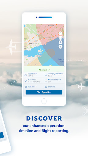
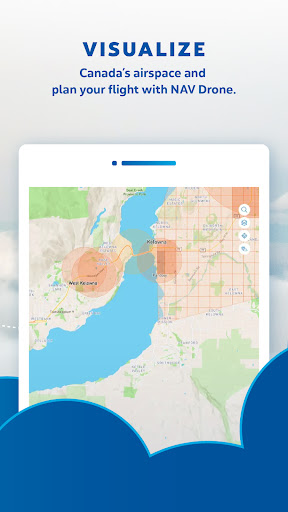
Fly your drone safely and legally in Canada’s controlled airspace with NAV Drone
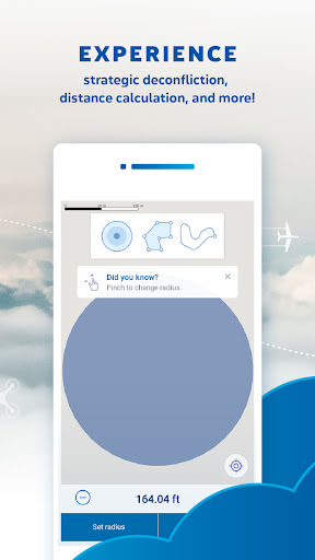
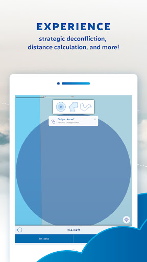
KEY FEATURES
⭐ Airspace information – Provides drone pilots with information on classification, restrictions, and NOTAMs.
⭐ Flight planning – Provides capabilities to schedule and plan flights in controlled airspace.
⭐ Flight authorization – Automates authorization responses to fly in controlled airspace.
Version Information
- Version
- -
- Downloads
- 10K+
- Updated on
- -
- Released
- Jan 17, 2026
- Requires
- Android Varies with device
Statistics
Google Play Rating History
Rating Distribution
Downloads Over Time
NAV Drone has been downloaded times. Over the past 30 days, it averaged downloads per day.
Shaded area shows 30-day prediction based on historical trends
Historical data collection started recently. More data points will be available over time.
NAV Drone users say on Google Play
 Andy Chevalier
The app is really handy to have in the field when things change and you need to be able to set up and go in short order. It shows the zones nicely so you know what up against readily. Good app.
 Konrad Rosenkranz-Galindo
This is a good app but does need a little TLC on the user interface, especially on the polygon-drawing area. The map cannot be re-sized while in the drawing mode and the radius option cannot be manually entered so you have to hold the + / - until you slowly get to your target number. Also, it would be fantastic if there were more export options of data. PDFs are only available in specific situations so you cannot export/print all missions; only specific ones. Otherwise, it is convenient and fast
 Matthew Fraboni
(UPDATED June 2025) Flight authorizations are really fast and app runs fairly well. However, it still keeps signing me out after I close it or after a few minutes (even with an active operation). Fields reset if you leave and come back to the app. Would like the option to save responses to the standard questions instead of having to answer the same question every time you request flight auth. Also when resizing the area of the operation needs a slider instead of a button that's increments of 1
 Aaron Bayes
Works best if you don't log in. Once you do, it won't give any info unless you tell it all about your drones, even the sub 250g. If you don't have a 250g+ drone registered with serial number etc then you just can't see info about that airspace for that kind of drone - unless you log out. Annoying.
 Randy Erickson
So many design flaws, not to mention the website. Edit: Apparently it's not government funded. Sure feels like a big brother app. Get rid of mandatory user ID and simplify mini drone information. As it is, the functionality is too forced and has serious user interface flaws complicating and confusing use. Easier to delete the app twice or three times after giving up due to hard to find settings.
ApkTrusted Ratings & Reviews
Scan this QR code to download

Forwarding you to the page at Google Play market in seconds...
Open Google Play market now