
Development Plans GIS vVARY
MapMagician


About this app
Developer Description
Shows Development plans and custom maps over Satellite Imagery
This is a privately developed GIS visualization and mapping application.
This app is NOT affiliated with, endorsed by, or connected to any government
agency or authority. It does NOT provide official government data, legal
records, or authoritative planning information.
Maps and layers shown in this app are independently processed into map
tiles and visualized for reference and spatial understanding only.
Publicly available planning documents may be referred to as general
reference material during visualization.
The information shown is NOT suitable for legal, regulatory, or official
purposes. Users must verify all details through official notifications
and relevant authorities before making decisions.
🌐 Interactive GIS Platform Features
• Satellite Imagery Overlay: Visualize planning layers on high-resolution satellite maps
• Measurement Tools: Calculate area and distance directly on interactive maps
• Zone Classification: View residential, commercial, industrial, and special zones
• Development Potential Analysis: Essential for real estate developers, valuers, investors, and urban planners
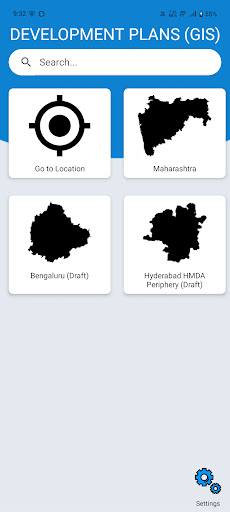
📍 Comprehensive Coverage – 157+ Locations Across Maharashtra, Hyderabad & Bengaluru
🏙️ Metropolitan Cities & IT Hubs
Hyderabad HMDA Periphery (30+ locations):
• Bibinagar • Ghatkesar • Medchal • Shamshabad • Chevella • Sangareddy • Patancheruvu • Maheshwaram
• Hayathnagar • Pochampalli • Choutuppal • Faruqnagar • Kandukur • Shahmirpet • 16+ more
Bengaluru City:
• Complete development plan coverage for India’s Silicon Valley
🟠 Major Maharashtra Multi-City Districts
Pune Region (54+ locations):
Pune City District:
• Pune • Pimpri Chinchwad • Baramati • Lonavala • Hadapsar • Kothrud • Wagholi • Indapur • 18+ areas
PMRDA Region:
• Hinjewadi IT Park • Chakan • Alandi • Talegaon • Shirur • Rajgurunagar • Shikrapur • 21+ towns
Mumbai Metropolitan Region:
• Navi Mumbai: Airoli • Vashi • Belapur • Nerul • Koparkhairane • Ghansoli • Sanpada
• Thane District: Thane • Dombivali • Kalyan • Bhivandi • Ulhasnagar • Asangaon
• Vasai-Virar Region: Vasai-Virar • Nala Sopara • Palghar • Dahanu
• Panvel Region: Panvel • Kharghar
✅ NEW: NAINA Region
NAINA – Navi Mumbai Airport Influence Notified Area
✅ NEW: MSRDC Region
MSRDC – Maharashtra State Road Development Corporation
Solapur District (15 towns):
• Solapur • Pandharpur • Akkalkot • Barshi • Kurduwadi • Sangola • Mangalwedha • Malshiras • Velapur • Akluj • Modnimb • Mandrup • Karmala • Tembhurni • Vairag
🟢 Western Maharashtra
• Satara • Karad • Shirwal • Khandala • Mhaswad • Malakapur
• Sangli • Miraj • Kupwad • Ashta
• Ahmednagar • Shirdi • Sangamner • IT Park
🟣 Marathwada Region
• Latur • Udgir • Ausa • Nilanga • Ahamadpur
• Osmanabad • Tuljapur • Umarga • Murum
• Aurangabad • Paithan
• Nashik • Trimbak
📌 Individual Cities
• Kolhapur • Dhule • Jalna • Hingoli • Amravati • Akola • Nanded • Jalgaon
• Nandurbar • Buldhana • Mira-Bhayandar • Nagpur Metropolitan
**Maharashtra Cities:**
1) Navi Mumbai Development Plan
2) Vasai-Virar/Nala-Sopara Development Plan
3) Pune Metropolitan Region Development Authority (PMRDA)
4) Pune City Development Plan
5) Solapur District Development Plan
6) Kolhapur City Development Plan
7) Satara City Development Plan
8) Nashik City Development Plan
9) Mira-Bhayandar Development Plan
10) Sangli Miraj City Development Plan
11) Thane/Dombivli (Part)/Bhivandi City/Ulhasnagar Development Plan
12) Aurangabad District part plans
13) Osmanabad City Development Plan
14) Latur City Development Plan
In-app purchases
$0.49 - $2.99 per item
Version Information
- Version
- -
- Downloads
- 10K+
- Updated on
- -
- Released
- Jun 3, 2025
- Requires
- Android Varies with device
Statistics
Google Play Rating History
Rating Distribution
Downloads Over Time
Development Plans GIS has been downloaded times. Over the past 30 days, it averaged downloads per day.
Shaded area shows 30-day prediction based on historical trends
Historical data collection started recently. More data points will be available over time.
Development Plans GIS - Google Play Rankings
Top Rankings
| Rank | Country | Category | List | Change |
|---|---|---|---|---|
| — |
Ranking History in
No ranking data available yet. Rankings are updated daily.
#9 in Top Grossing Maps And Navigation in India


Development Plans GIS users say on Google Play
 Shanti Senghani
Sir, its an good initiative, but how much it cost and pls add more cities.
 sachin dalvi
This app is very helpful but yesterday on 21 April 2023 I paid for Thane region subscription but its it show you are not subscribe..please resolve this
 Ar. Piyush Khadke
Jalgaon City not available in this app please update this app
 SOMNATH KHOCHARE
Incorrect overlapping of most thr maps. Not accurate overlapping.
 kishor gondhale
DISTRICT -THANE TALUKA -KALYAN ATALI AMBIVALI MAP GIS MAP SHOWS WRONG BOUNDRY APROX 10-20 METER IN MOST SURVE OF MOHILI ,BALYANI VILLAGE IT CREATE CONFUSIONS AND DISPUTE BETWEEN LAND OWNERS. SAME ISSUE HIGHLIGHT TO DEVELOPER BY MAIL PROVIDING KDMC CITY GIS MAP SCREEN SHORT ,CITY SURVEY MAP STILL NO CORRECTION TAKEN.. ALL SURVEY SHOULD MOVE FROM WEST TO EAST BALYAN 116 SURVEY TO 86 SURVEY SATRTING POINT HAVE DISTANCE 73 METER CITY SURVEY MAP... AND IN GIS MAP IT SHOWS 41 METERS .. WORST APP
ApkTrusted Ratings & Reviews
More from MapMagician
See more apps
Scan this QR code to download

Forwarding you to the page at Google Play market in seconds...
Open Google Play market now