
GPS Camera Map & Geotag Photos v1.3.1
duong huynh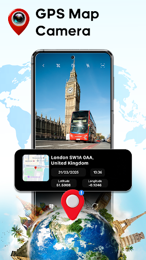

About this app
Developer Description
GPS Camera Map: Easily geotag photos & videos! Add timestamp, location and date
Transform your photo-taking experience with our advanced GPS Camera app that automatically captures and preserves the exact location of every moment. Perfect for travelers, photographers, and anyone who wants to maintain an organized visual diary of their adventures.
Key Features of GPS Camera Map & Geotag Photos
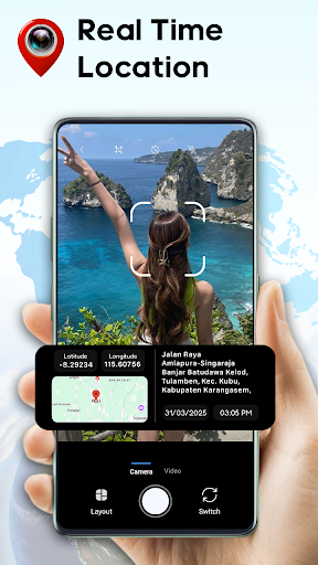
📸 Intelligent Location Auto-Tagging
🤳 Automatic GPS coordinates in real-time
🎞 Smart location recognition system
🎬High-resolution photo and video capture
💫Customizable folder templates
🎥 High-quality video recording
📸 Existing photo geotagging
🤳 Smart album creation
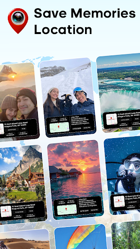
Auto Tag Locations – Recall Every Place Instantly
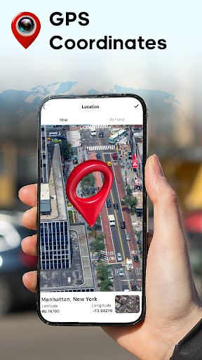
The GPS Camera app automatically adds precise GPS coordinates, addresses, or even custom locations to your photos and videos. Relive every adventure by knowing exactly where each moment happened.
Capture the Moment & Location with Accuracy
Combine your memories with pinpoint location accuracy. Whether you're exploring new destinations, documenting work, or revisiting familiar places, the GPS Camera tags every photo with the right data.
Camera Snap with Timestamps for Photos & Videos
Use the GPS Camera to capture photos and videos with real-time timestamps. Preserve the exact moment each memory was created by adding precise date and time information.
Custom Date & Time
Need to make adjustments? With the GPS Camera, you can set custom dates and times for your geotag photos and videos. Perfect for correcting metadata or cataloging historical images.
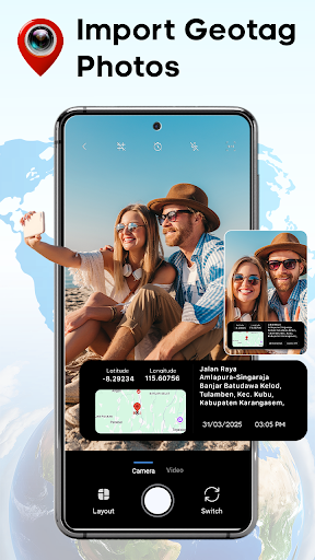
Import Existing Photos
Bring your old photos to life with the GPS Camera! Import existing photos, add geolocation tags, timestamps, and customize metadata to create a cohesive, well-organized library.
Library for Geotag Photos & Videos
Organize your memories with the GPS Camera's intuitive media library. Quickly access, manage, and search for your geotagged photos and videos all in one place.
Diverse Templates for Every Occasion
The GPS Camera provides a variety of customizable templates to enhance your photos. Add geotags, timestamps, and other metadata in styles that suit travel memories, work projects, or personal organization.
With GPS Camera Map & Geotag Photos, you can take your photography to the next level. Use diverse templates to personalize your images, geotag every moment, and keep your memories organized.
Download now and start geotagging your memories today!
In-app purchases
$5.99 - $19.99 per item
Version Information
- Version
- 1.3.1
- Downloads
- 10M+
- Updated on
- Dec 22, 2025
- Released
- Jul 30, 2024
- Requires
- Android 7.0
Statistics
Google Play Rating History
Rating Distribution
Downloads Over Time
GPS Camera Map & Geotag Photos has been downloaded times. Over the past 30 days, it averaged downloads per day.
Shaded area shows 30-day prediction based on historical trends
Historical data collection started recently. More data points will be available over time.
GPS Camera Map & Geotag Photos - Google Play Rankings
Top Rankings
| Rank | Country | Category | List | Change |
|---|---|---|---|---|
| — |
Ranking History in
No ranking data available yet. Rankings are updated daily.
#25 in Top Free Photography in Turkey
 Toonpics - Cartoon Photo Edit
GPS Camera Map & Geotag Photos
Toonpics - Cartoon Photo Edit
GPS Camera Map & Geotag Photos
 Time Warp Scan | Face Scanner
#43 in Top Free Photography in Brazil


#48 in Top Free Photography in Mexico

#65 in Top Free Photography in Spain


GPS Camera Map & Geotag Photos users say on Google Play
 Elijah Dundas
My experience is excellent and safe with this app going forward and see many places that i never went before ìts good.
 Yashwant Singh
nice 👍 keep it up
 Karma Sherpa
thanks for your kindness and support 🙏🏼🙏🏼🙏🏼
 Levi Croker
Same function as normal map. I hope sometime in the future someone can create a true live satellite map that can capture real time activities around tye world.
 keith machoka
Useless app. does not do what is shown. Adverts after every 30 seconds. Total waste of time and storage.
ApkTrusted Ratings & Reviews
More from duong huynh
See more apps


Scan this QR code to download

Forwarding you to the page at Google Play market in seconds...
Open Google Play market now