
被害予測・防災cmap v3.2.5
あいおいニッセイ同和損保


About this app
Developer Description
Building damage prediction, SNS bulletin, alert
=================
This place is amazing!
- Predicts the number of buildings damaged by typhoons, heavy rains, and earthquakes and displays them on a map.
・Displays SNS information regarding regional risks. You can also post information about risks that are familiar to you.
- We will provide you with illustrated advice in the event of an earthquake, wind and flood damage, heavy snow, etc.
- You can receive hail and torrential rain alerts up to 30 minutes in advance (up to 60 minutes in advance for torrential rain).
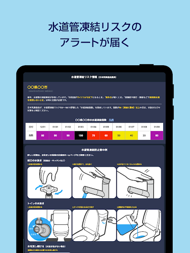
・You can receive push notifications if the risk of water pipe freezing increases over the next 10 days.
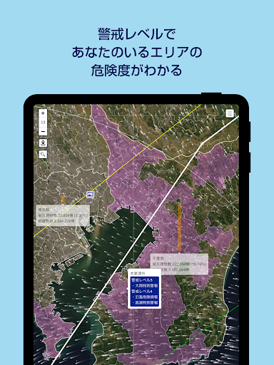
・You can see the degree of danger in the area surrounding the user by displaying alert levels 3 to 5.
・You can receive emergency information such as heavy rain special warnings and evacuation instructions through push notifications. Furthermore, you can register two areas in addition to your current location, so you can check risk information in distant areas.
=================
Prepare for risks!
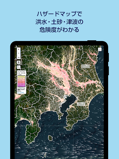
- You can see the risk level of floods, landslides, and tsunamis with hazard map information.
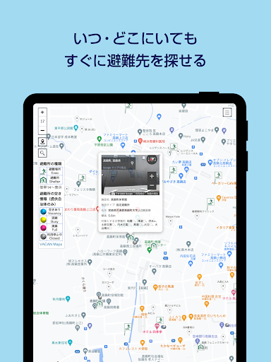
・You can check the location information of evacuation sites and shelters at any time.
=================
Full of useful information for daily life!
- Information on weather forecasts and lifestyle indicators (laundry index, umbrella index, etc.) can be found.
・You can check the location of barrier-free toilets and elevators on the barrier-free map.
・You can check traffic jam information.
=================
Peace of mind even in case of emergency!
・Aioi Nissay Dowa Insurance will provide policyholders affected by the disaster with information such as contact information for the accident reception desk.
What's New
Version Information
- Version
- 3.2.5
- Downloads
- 10K+
- Updated on
- Nov 14, 2025
- Released
- Jul 30, 2020
- Requires
- Android 7.0
Statistics
Google Play Rating History
Rating Distribution
Downloads Over Time
被害予測・防災cmap has been downloaded times. Over the past 30 days, it averaged downloads per day.
Shaded area shows 30-day prediction based on historical trends
Historical data collection started recently. More data points will be available over time.
ApkTrusted Ratings & Reviews
More from あいおいニッセイ同和損保
See more apps


Scan this QR code to download

Forwarding you to the page at Google Play market in seconds...
Open Google Play market now