
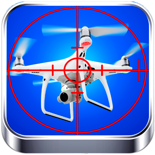
Drone Radar - Drone Detector v3.6.0
AppZeeInc


About this app
Developer Description
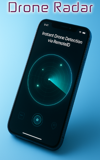
Detect, track & find nearby drones with live radar, Remote ID, and flight map
Whether you’re a drone enthusiast, pilot, or simply curious about what’s flying above, Drone Radar gives you a live radar map showing active UAVs broadcasting Remote ID signals.
Using advanced Bluetooth, Wi-Fi NAN, and Wi-Fi Beacon scanning, it detects nearby drones and displays key flight details such as altitude, speed, direction, and ID — giving you a complete picture of local drone air traffic.
✈️ Key Features
🔹 Drone Detector & Scanner – Identify drones nearby using Remote ID broadcasts.
🔹 Live Drone Radar Map – See active drones in your area in real time.
🔹 Drone Flight Tracker – Monitor drone altitude, speed, and flight direction.
🔹 Drone Finder & Location Map – Pinpoint exact positions of UAVs near you.
🔹 Bluetooth & Wi-Fi Detection – Supports all major Remote ID standards.
🔹 FPV Radar & UAV Tracker – Detect FPV and GPS drones in your airspace.
🔹 Open Drone ID Support – Built on open-source, standards-compliant technology.
🔹 Drone Air Traffic View – Visualize local drone flights just like radar aviation.
🌍 Perfect For
🔹Drone lovers who enjoy spotting nearby flights
🔹Pilots wanting awareness of other drones
🔹FPV racers monitoring active UAVs
🔹Tech enthusiasts exploring Remote ID signals
🔹 Event organizers ensuring safe skies
⚙️ How It Works
1. Open Drone Radar anywhere — home, field, or event.
2. Tap Scan to detect active drones broadcasting Remote ID.
3. Watch them appear on your live map, complete with flight details.
Drone Radar is more than just an app — it’s your personal sky tracker, built for awareness, safety, and discovery.
Stay informed. Stay safe.
See the unseen. Explore the skies
What's New
Version Information
- Version
- 3.6.0
- Downloads
- 10K+
- Updated on
- Oct 14, 2025
- Released
- Oct 14, 2025
- Requires
- Android 6.0
Statistics
Google Play Rating History
Rating Distribution
Downloads Over Time
Drone Radar - Drone Detector has been downloaded times. Over the past 30 days, it averaged downloads per day.
Shaded area shows 30-day prediction based on historical trends
Historical data collection started recently. More data points will be available over time.
Drone Radar - Drone Detector users say on Google Play
 ကို ကို
good
 Osama Fares
Yes it's very good
 Loy Griffin
I'm looking at a drone in the sky this app says there no drone around
ApkTrusted Ratings & Reviews
More from AppZeeInc
See more apps
Gold Metal Detector StudFinder
Free
Arduino Drone Remote Control
Free

Drone Controller App Micro XDU
Free
Quadcopter Drone RC All Drones
Free

Tello Drone Remote Controller
Free
Drone Jammer & Drone RC Prank
Free
Raspberry PI Drone Controller
Free
Universal AC Remote: IR App
Free

Crypto News: crypto exchange
Free
Smart Home Remote: Arduino BT
Free
Sound Meter - Decibel & Noise
Free
Gold Detector:All Metal Finder
Free
Video Converter, MP3 Converter
Free

Crazyflie Drone Remote Control
Free
Scan this QR code to download

Forwarding you to the page at Google Play market in seconds...
Open Google Play market now