Hurricane & Typhoon Track v6.75
H & Y Studio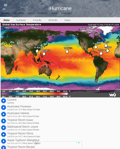


About this app
Developer Description
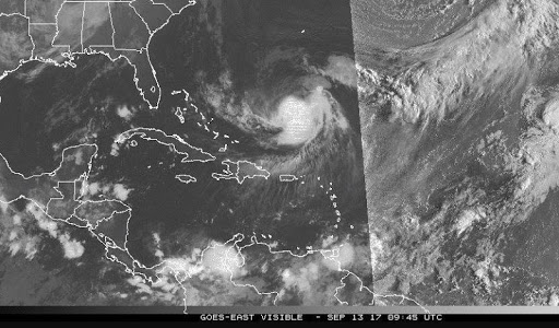
Track and forecast storm ,Typhoon and hurricane path in the Global Ocean
Also, you will be able to stay informed on the status of the local and national power grid and surge probability.
Here are the key highlights of this application...
* Quick overview of active hurricanes, tropical storms, depressions, and other cyclones
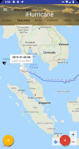
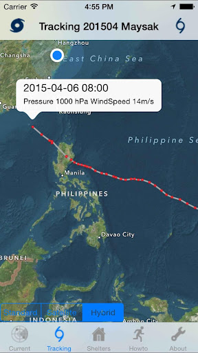
* Get real-time Hurricane & Typhoon Tracking
* Emergency Shelters
* Tap on any map to view full screen, with pinch-to-zoom, drag, and scroll support, even during loop playback
* Current Storm Location
* Computer Models
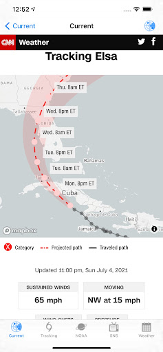
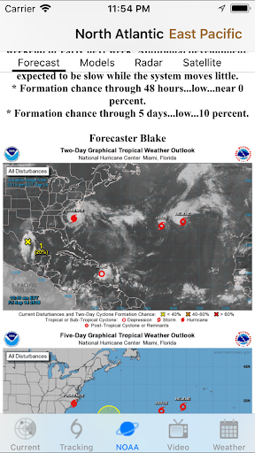
* Forecast cones (5-day uncertainty track), wind speed probability, storm surge maps (when available), and GOES Floater satellite imagery
* Storm Surge Probability
* Optional Forecast Model Viewer Add-On: View forecast models (also known as spag models) for active systems on an interactive map complete with panning, zooming, and individual model point information when tapped. Features selectable models, start time, and run length
* Sharing of screenshots with any app that supports it (Facebook, Twitter, etc.)
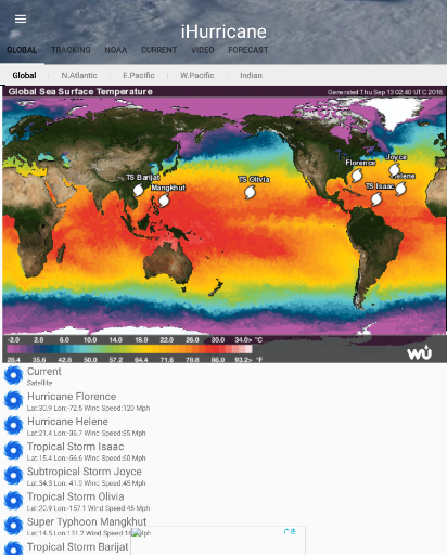
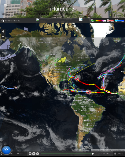
* Multiple types of regional summary maps and satellite loops to choose from (full list below)
* Road Maps
* Historical Map
* Per-storm advisory & discussion text from the experts at the National Hurricane Center, Public & Marin Advisory
**************************************
all the data is just from National Oceanic and Atmospheric Administration, (NOAA)
Stay informed about the latest tropical systems in the Atlantic,Pacific,Indian Ocean and Caribbean . Get the most recent maps and forecast details about active storms.
What's New
Version Information
- Version
- 6.75
- Downloads
- 100K+
- Updated on
- Aug 13, 2025
- Released
- Mar 29, 2018
- Requires
- Android 6.0
Statistics
Google Play Rating History
Rating Distribution
Downloads Over Time
Hurricane & Typhoon Track has been downloaded times. Over the past 30 days, it averaged downloads per day.
Shaded area shows 30-day prediction based on historical trends
Historical data collection started recently. More data points will be available over time.
Hurricane & Typhoon Track - Google Play Rankings
Top Rankings
| Rank | Country | Category | List | Change |
|---|---|---|---|---|
| — |
Ranking History in
No ranking data available yet. Rankings are updated daily.
#82 in Top Free Weather in Philippines

#138 in Top Free Weather in Vietnam
Hurricane & Typhoon Track users say on Google Play
 Myo Han Thit
Good app useful ...
 A Google user
Good app useful for me
A Google user
Useless. IHerb adverts keep pop up. Can't move map to see area of interest
 Byron Jackson
Ads were painfully loud and intrusive. I don't want ads about excrement to be blasted all over the bus I am on. Turns me OFF buying the paid version Could NOT get it to show predictions for anywhere but America, couldn't get it to show projected track for Yasa. It took 2 or 3 goes to get it to start on my phone so I re installed it and and now won't run at all. Pity it might have had potential.
ApkTrusted Ratings & Reviews
Scan this QR code to download

Forwarding you to the page at Google Play market in seconds...
Open Google Play market now