
India Political Map With State vVARY
AAB Store

About this app
Developer Description
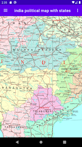
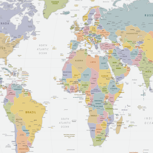
India political map with states and capitals
Discover and explore the intricate political landscape of India with our India Political Map app. Dive into the rich diversity of India's states and union territories through an interactive and detailed map. Whether you're a student, traveler, or geography enthusiast, our app provides a comprehensive and user-friendly platform to understand the political divisions of India.
Key Features:
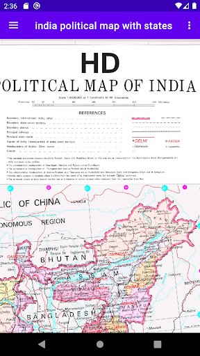
🌍 Detailed Political Map: Explore a high-quality and interactive map of India, showcasing the country's states, union territories, and their boundaries. Gain a comprehensive understanding of India's political structure and divisions.
🔍 Easy Navigation: Use our intuitive navigation tools to zoom in and out, pan across the map, and effortlessly explore different regions. Locate specific states, union territories, cities, or landmarks with ease.
📖 Educational Insights: Expand your knowledge with fascinating facts about each state and union territory of India. Discover information such as capitals, population, area, and significant landmarks, providing valuable educational insights.
📷 Satellite View: Switch to satellite view and witness India's geographical features come to life. Explore mountains, rivers, forests, and major cities from a unique perspective.
📍 Bookmark and Favorites: Mark your favorite states, union territories, or landmarks for quick access. Create a personalized collection of your most frequently visited or significant places on the map.
📱 Offline Access: Enjoy the convenience of accessing the India Political Map even when you're offline. Once downloaded, the map and its features can be accessed anytime, anywhere, without an internet connection.
📸 Easy Sharing: Share screenshots or specific locations from the India Political Map with friends, family, or colleagues. Collaborate on projects or travel plans by easily sharing map details.
🌐 Multilingual Support: Our app supports multiple languages, ensuring accessibility for people from various regions and linguistic backgrounds.
🆓 Free and Ad-Free: Experience a premium, ad-free app without any distractions. Our app is completely free to download and use, providing a seamless user experience.
Whether you're studying Indian politics, planning a trip, or simply intrigued by India's political landscape, our India Political Map app is your ultimate companion. Stay informed, expand your knowledge, and navigate India with confidence.
Download the India Political Map app now and embark on a journey of exploration and discovery!
Note: Our app is optimized for Android devices and requires an active internet connection for initial download and updates.
Download now and unravel the political tapestry of India!
[Keywords: India Political Map, India Map, Indian States, Union Territories, Political Landscape, India Geography, India Travel, India Education, India Politics]
India's political map with states and capitals list
Andhra Pradesh (Amaravati)
Arunachal Pradesh (Itanagar)
Assam (Dispur)
Bihar (Patna)
Chhattisgarh (Raipur)
Goa (Panaji)
Gujarat (Gandhinagar)
Haryana (Chandigarh)
Himachal Pradesh (Shimla)
Jharkhand (Ranchi)
Karnataka (Bangalore)
Kerala (Thiruvananthapuram)
Madhya Pradesh (Bhopal)
Maharashtra (Mumbai)
Manipur (Imphal)
Meghalaya (Shillong)
Mizoram (Aizawl)
Nagaland (Kohima)
Odisha (Bhubaneshwar)
Punjab (Chandigarh)
Rajasthan (Jaipur)
Sikkim (Gangtok)
Tamil Nadu (Chennai)
Telangana (Hyderabad)
Tripura (Agartala)
Uttarakhand (Dehradun)
Uttar Pradesh (Lucknow)
West Bengal (Kolkata)
Union Territories
Andaman and Nicobar Islands (Port Blair)
Chandigarh (Chandigarh)
Dadra and Nagar Haveli and Daman & Diu (Daman)
The Government of NCT of Delhi (Delhi)
Jammu & Kashmir (Srinagar-S*, Jammu-W*)
Ladakh (Leh)
Lakshadweep (Kavaratti)
Puducherry (Puducherry)
* S (Summer) and * W (Winter)
Version Information
- Version
- -
- Downloads
- 1K+
- Updated on
- -
- Released
- Jan 31, 2023
- Requires
- Android Varies with device
Statistics
Google Play Rating History
Rating Distribution
Downloads Over Time
India Political Map With State has been downloaded times. Over the past 30 days, it averaged downloads per day.
Shaded area shows 30-day prediction based on historical trends
Historical data collection started recently. More data points will be available over time.
India Political Map With State users say on Google Play
 Surya Mol
sogood
 DANI JI
state ka alag map hai hi nahin
ApkTrusted Ratings & Reviews
More from AAB Store
See more apps


Scan this QR code to download

Forwarding you to the page at Google Play market in seconds...
Open Google Play market now