iHunter Ontario v5.0.51
Inside Outside Studios Inc.


About this app
Developer Description
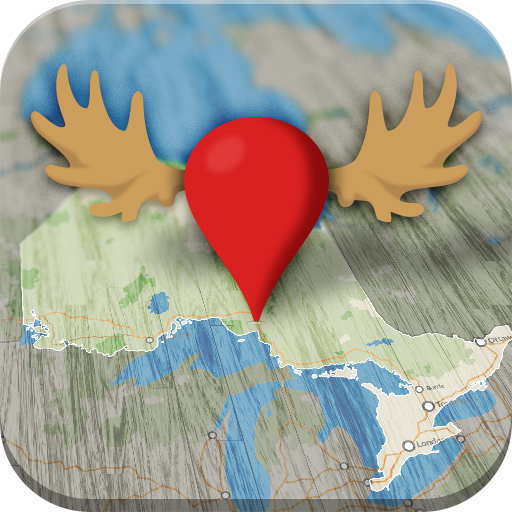
iHunter Ontario - Know your WMUs inside and out.
Features (Most functional offline):
• View Hunting zones overlaid on your choice of map.
• Multiple satellite, topographic, and road maps included which automatically caching for offline use.
• Add waypoints to the map at your current location, known GPS locations, or by tapping on the map.
• Log in to back up and synchronize waypoints and preferences across devices.
• Utilize the sunrise/sunset calculator to determine legal hunting light at your location or a waypoint.
• Share your current location with friends or family via email or text for easy location tracking requires internet.
• Display weather at your current location or a waypoint (requires internet).
• First Nations Reserve boundaries.
• Import waypoints and tracks from GPX, KML, and KMZ files.
• Track your position, speed, and altitude; draw over the map; search the map; view recently viewed and favourited items. (Note: Continued use of GPS running in the background can significantly decrease battery life).
There are two subscription options to enhance the iHunter app:
With an iHunter Core yearly subscription, you will receive:
• Access to select hunting zones to view summaries of big-game, predators, game birds, and small game seasons (works offline).
• Ability to select regions of base maps and map layers to cache for offline use.
• Unlimited waypoints, tracks, and drawings.
• Capability to add your own TMS and WMS map layers.
• Wind condition display by location (requires internet).
• 3D base maps.
With an iHunter Pro yearly subscription, you will receive:
• All features included in the Core Subscription.
• Android Auto integration.
• iHunter layers in driving navigation for both Android Auto and in-app navigation.
• Additional public and private land layers. The available layers differ for each province. See https://www.ihunterapp.com/ for more information.
In-app purchases
$3.49 - $32.99 per item
Version Information
- Version
- 5.0.51
- Downloads
- 10K+
- Updated on
- Jan 7, 2026
- Released
- Jul 22, 2013
- Requires
- Android 7.0
Statistics
Google Play Rating History
Rating Distribution
Downloads Over Time
iHunter Ontario has been downloaded times. Over the past 30 days, it averaged downloads per day.
Shaded area shows 30-day prediction based on historical trends
Historical data collection started recently. More data points will be available over time.
iHunter Ontario - Google Play Rankings
Top Rankings
| Rank | Country | Category | List | Change |
|---|---|---|---|---|
| — |
Ranking History in
No ranking data available yet. Rankings are updated daily.
#24 in Top Grossing Sports in Canada


iHunter Ontario users say on Google Play
 Eric Neufeld
I love this app - I've found it to be very useful for hunting as a way to mark waypoints for tracks and sign, treestand locations. I also use it to mark patches of mushrooms and other wild edibles. Also helpful to determine the boundaries of a piece of land to keep me from wandering onto private property. I also love how I can use the desktop/web version from my computer when I'm e-scouting. I've been a loyal customer for 4 years and only had to reach out to support once. They responded and fixed the issue for me in a matter of minutes. All in all, totally worth the money and I look forward to continuing to use it for years to come.
 Al Christie
Great app. Works off line I was able to transfer all my waypoints and tracks from my garmin to this without issue. I am able to put all my friends who use the app on a contact list to share and text with while the app is open. Would have given it 5 stars if it were not for the map details. When using the maps with private land turned on. There are stripes that blur the map.
 Ken Nicholas
I've only jad the app less than a day. And I am not impressed that much. The overlays are oit by quite a bit when it comes to property boundaries and they have my property listed as a public conservation area. This is a general app which gives a rough idea. But it should always be cross referenced with other maps when it comes to public lands. And county maps made available are not reliable either. They have mad the exact same mistakes.
 J Allen
Downloaded the first portion of this app today looking to find Crown Land to hunt on. Only to find out that you actually need to spend another $39.99 per year to have access to those Maps. Disappointing!!! Seeing as those Crown land use maps are for free from the Ontario government. Why are you price gouging us guys? I'D LIKE A REFUND!
 Matt Gregoire
I bought into this app years ago and liked the way it operated. I even help to put the original administraters, who were awesome to deal with back then, in touch to the proper people to get the public land integrated into the programing. I am just blown away at the huge increase in a $8 a year app into this $40 charge they now demand.... completely over priced now and I will be looking for something new... totally disappointed
ApkTrusted Ratings & Reviews
More from Inside Outside Studios Inc.
See more apps


Similar Apps

BaseMap: Hunting Maps and GPS
Free
BassForecast: Fishing Forecast
Free

Harvest Hosts - RV Camping
Free

KOA Camping | RV, Cabin & Tent
Free

HuntStand: GPS Maps & Tools
Free
Recreation.gov
Free

Moultrie
Free

Hipcamp: Camping, RVs & Cabins
Free

TrailLink: Bike, Run, Walk
Free

ParkUsher: Find Parking Easily
Free

Deep Dive - Bass Fishing App
Free

ClickOnDetroit - WDIV Local 4
Free

Find Local, Black-owned Eats!
Free

Ballad Health
Free

TeeTime Golf Pass
Free

Farmer Boys
Free
Scan this QR code to download

Forwarding you to the page at Google Play market in seconds...
Open Google Play market now