3D maps (Terrain) vVARY
우승호


About this app
Developer Description
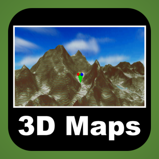
Cover the world in detail 3D terrain map. Finding peaks(290,241) of the world.
This app always knows and uses the current location even when running in the foreground as well as in the background.
To cover whole world in detail 3D terrain map.
Finding peaks(290,241) of the world
This application covered whole world 3D terrain map based on tile service.
You can use several Open Street Map.
OSM map tiles and elevation data are downloaded only one time.
Downloaded data are utilized as off-line data.
Your outdoor tracking(ski,climbing,running,flight etc.) data is 3D basically.
Save 3D track and Review it.
Track saving format WOO,IGC(enable validation),KML,GPX is available.
Import track format also is same.
Enjoy whole world 3D track history.
Elevation data's max resolution is 30m×30m.
Version Information
- Version
- -
- Downloads
- 500+
- Updated on
- -
- Released
- Oct 19, 2014
- Requires
- Android Varies with device
Statistics
Google Play Rating History
Rating Distribution
Downloads Over Time
3D maps (Terrain) has been downloaded times. Over the past 30 days, it averaged downloads per day.
Shaded area shows 30-day prediction based on historical trends
Historical data collection started recently. More data points will be available over time.
3D maps (Terrain) users say on Google Play
 A Google user
This is the one for terrain and eveb every view of hills .ios terrain 4wd app a $100 which is proberbly useless. here get this.
A Google user
Log and your GPS routes then view them back in 3D rendering. Begin able to visualise terrain is a fantastic tool for planning future routes. I have experienced frame gitter at high zoom levels. This app is showing wonderful potential. With a little refinement I would purchase it as it is the best available on in its class. Keep up the work. .(edit 15/08/2015) With the last update zoom issues have been fixed.
A Google user
It takes ages or 3D maps to load when zooming in and out. Not easy to use. I requested a refund about 120 seconds of using it.
ApkTrusted Ratings & Reviews
More from 우승호
See more apps


Scan this QR code to download

Forwarding you to the page at Google Play market in seconds...
Open Google Play market now