World Atlas MxGeo Pro v9.6.2
HPB Labs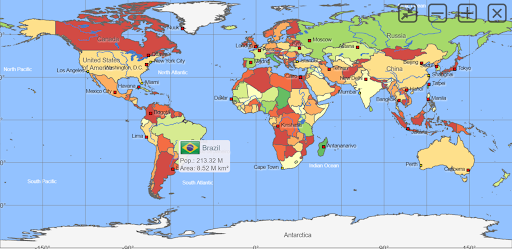


About this app
Developer Description
Learning app for geography. More than 260 countries and territories of the world
Designed for smartphones and tablets.
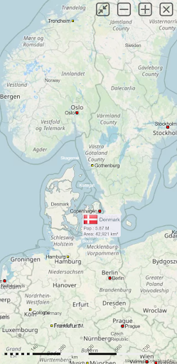
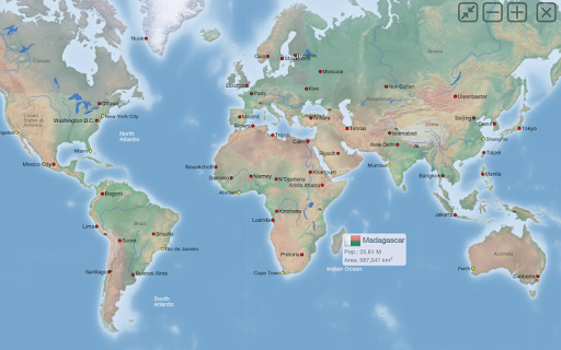
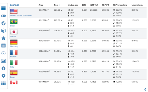
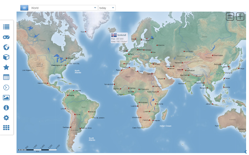
• Maps, flags and comprehensive data for more than 260 countries and territories of the world
• Search for countries, major cities, rivers and mountains or coordinates
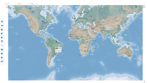
• Interactive political world, continent and country maps
• Shaded relief layer for world and continent maps
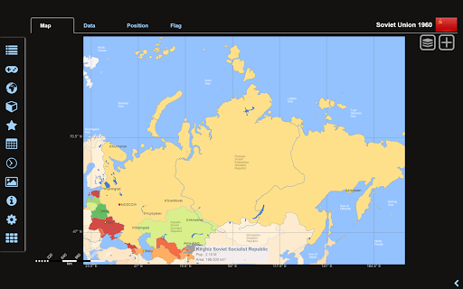
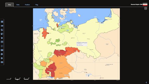
• Historical political world and continent maps of 1900 and 1960
• Geography quiz challenge for playful learning
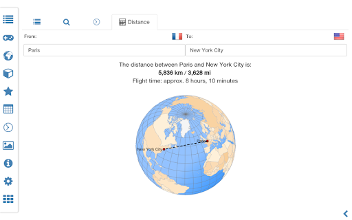
• Country comparison, favorites and distance calculator
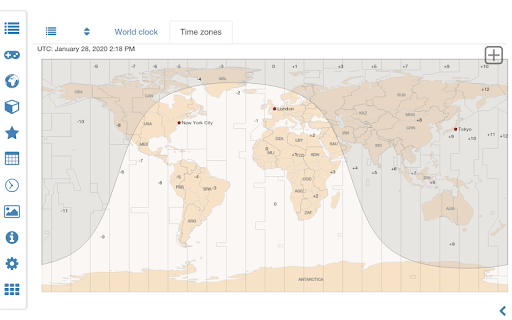
• World clock with time zone display
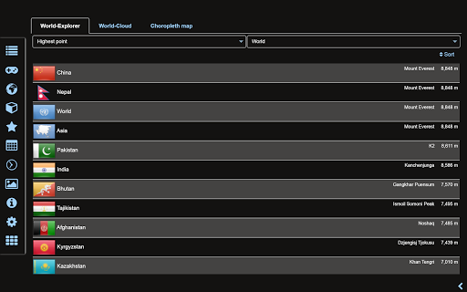
• World-explorer: the smallest, largest, wealthiest, and most populated countries of the world
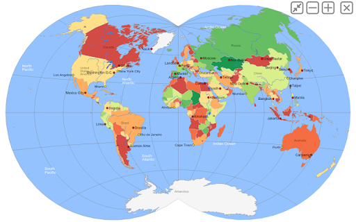
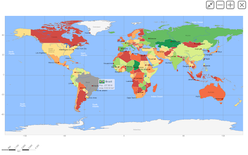
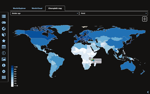
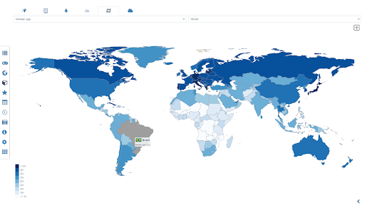
• Choropleth maps: temperature, area, HDI, population, ...
• No online connection required
• No advertising or In App Purchases
• No permissions required
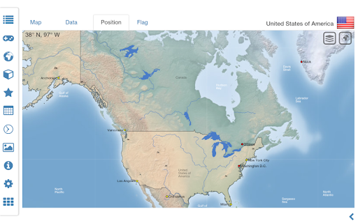
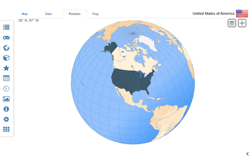
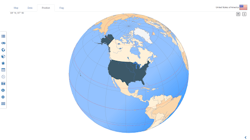
Explore the world through political continent and country offline maps. Whether Europe, Africa, Asia, Oceania, South and North America: maps of all continents and countries are included. Learn where each country in the world is located. View its position highlighted on a digital globe. Create your favorite color theme or choose from different color schemes for map display.
Do you know the flag of Mauritius? Yes? Perfect. Do you also know in which country Mount Everest is located?
“World atlas & world map MxGeo Pro” Quiz helps you acquire a geographic literacy in a playful manner.
Choose from seven geo guessing games:
• Test your knowledge about the capitals in the world
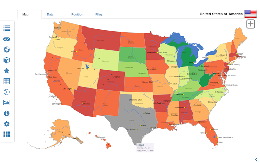
• Guess the Federal states for selected countries (USA, Germany, Brazil,..)
• Recognize the proper country flag based on the outline map
• Do you know the top-level domains of the world's countries?
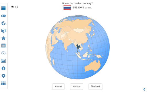
• Guess the highlighted country on the virtual globe
• Guess the right country by the flag
• Do you know the ISO countries codes of the world?
• Do you know the mountains of the world?
Each quiz offers seven regional variants: World, Europe, Africa, Asia, Oceania, South or North America.
Geo learning app and educational game which is fun for everyone whether children, adults, seniors or teachers. Get ready for your next stay abroad while enjoying this great world almanac including time zones and statistical data, such as population growth, unemployment rate, average age, gross domestic product (GDP) by sector and other key figures. Or prepare for your next geography lesson with this genius digital world map. If not traveling our world atlas lets you explore the world just only virtually.
Enjoy the comprehensive atlas of the World including Europe, Asia, North America, Africa, Oceania and South America with all countries and regional units, capitals and flags.
What's New
• Bug fixes and improvements
9.x:
• World and continent maps of climate classes
• Country comparison: charts for time series based data
• New chart: Population distribution
8.x:
• Print maps and country data
• Historical world and continent maps of 1900, 1930 and 1960
• Search for countries, major cities, rivers, mountains, islands, lakes and coordinates
• World Explorer: largest cities, longest rivers and highest mountains
Version Information
- Version
- 9.6.2
- Downloads
- 10K+
- Updated on
- Nov 24, 2025
- Released
- May 31, 2015
- Requires
- Android 7.0
Statistics
Google Play Rating History
Rating Distribution
Downloads Over Time
World Atlas MxGeo Pro has been downloaded times. Over the past 30 days, it averaged downloads per day.
Shaded area shows 30-day prediction based on historical trends
Historical data collection started recently. More data points will be available over time.
World Atlas MxGeo Pro - Google Play Rankings
Top Rankings
| Rank | Country | Category | List | Change |
|---|---|---|---|---|
| — |
Ranking History in
No ranking data available yet. Rankings are updated daily.
#9 in Top Paid Education in Italy


#9 in Top Paid Education in Brazil


#13 in Top Paid Education in France


#18 in Top Paid Education in Germany


World Atlas MxGeo Pro users say on Google Play
 Terminus 844
Have been using the free version for a little over a year and found it to be very nicely done. Having recently upgraded to the pro version, I find that I like the app even better. If you are mainly interested in basic world geography then the free version is great, but the wealth of additional info provided by pro makes it totally worthwhile for those seeking more comprehensive knowledge.
 Uthman Muhajab
The app is well set-up and well informative 🤜🤛. Though, needs a little bit touch improvements on some countries database is seemed to be too old and some map of the countries are not proportional on their sizes on the map; for instance when you compare Germany and Sweden you might think Germany in the map smaller but infect it is bigger than Sweden.
 A Google user
Updating my review. Thanks for acknowledging may previous review. "My concern is, why that dotted line not showing in world map". For your information: J&K, Siachen Glacier is not a disputed area. POK(Pakistan Occupied Kashmir) is so. Atleast go through what is right
 Robert Charlesworth
Disappointing level of detail. Nothing much visible at county level in the USA (or Oblast level in the Ukraine for instance), even if you click on a county to zoom in (you then lose the context anyway). Also search function sometimes misses major cities and even regions. I'm giving it two stars because it actually works, but it didn't do what I wanted, so was a waste of money. For kids or casual use I suppose it's OK, but it isn't a serious atlas, the kind you can buy in a book store.
A Google user
cluncky and incomplete.
ApkTrusted Ratings & Reviews
More from HPB Labs
See more apps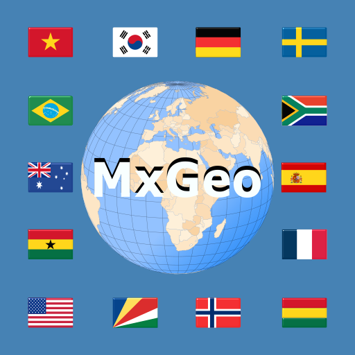
Similar Apps

Toddlers Solar System 2+
Free

What's in Space?
Free

My Green City
Free

How Are Things Made?
Free
How It Works?
Free
King of Math Jr - Lite
Free

How did Pirates Live?
Free

Readaboo
Free

Charge the Robot
Free

Funexpected Math for Kids
Free

The Allen Adventure
Free

Magrid - Early Math Learning
Free
Times table ANIMATICS
Free

AtlasKeeper Kids Learning Game
Free

Animal Facts
Free

Pok Pok | Montessori Preschool
Free
Scan this QR code to download

Forwarding you to the page at Google Play market in seconds...
Open Google Play market now