BackCountry Navigator GPS PRO v8.0.5
Nii Game INC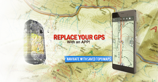


About this app
Developer Description
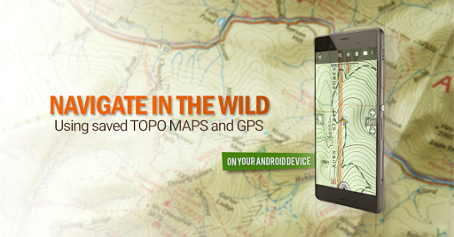
Play in the outdoors with Android as your Handheld GPS and offline topo maps!
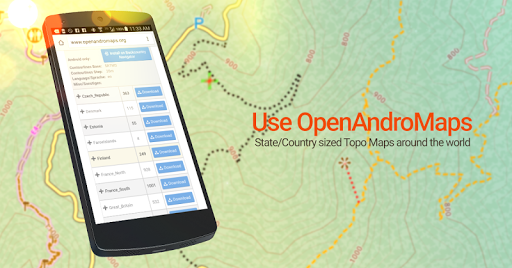
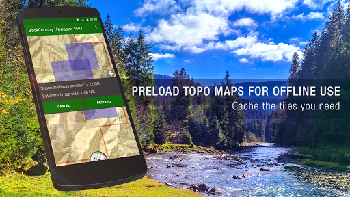
Download topo maps for the US and many other countries in advance, so you won't need cell coverage for navigation. Use storage memory for maps.
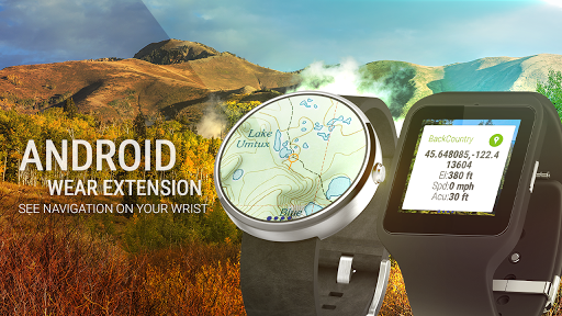
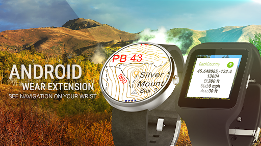
New: Android Wear support to see navigation at a glance on wrist
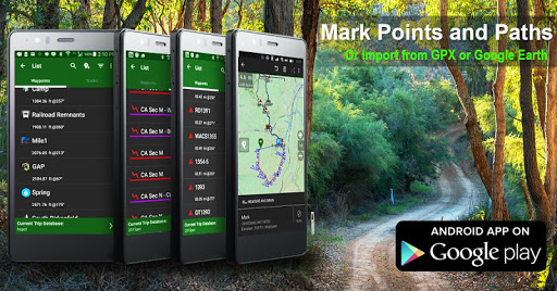
Use GPS waypoints from GPX or KML files, or enter your own coordinates using longitude/latitude, UTM, MGRS, or grid reference. Using GOTO makes a waypoint a locus for navigation.
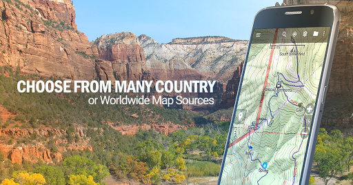
This uses many publicly available map sources as free downloads. Some additional content available as an in app purchase:
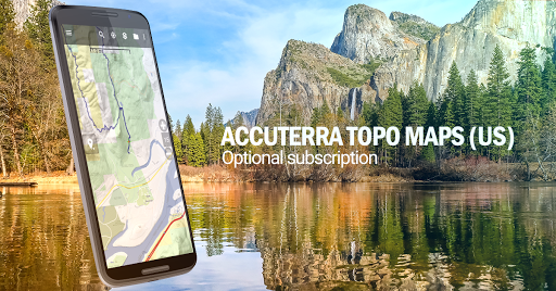
-Accuterra Topo Map Source for $19.99/year. This can be purchased and used with or in instead of the free sources.
-Thunderforest Map Sources - worldwide for $11.99 per year.
- Boundary maps for 12 western states from the Bureau of Land Management(BLM) Overlay for topo maps valued by hunters.
-GMU boundaries in some states
-Lake Contours in several states.
-Content from US TrailMaps including:
-ATV, Whitewater, and Equestrian Trail Maps
See the menu under More-> "Purchasing AddOns". They can be shown on top of topo maps.
You may try the DEMO version to make sure you like the maps in your country.
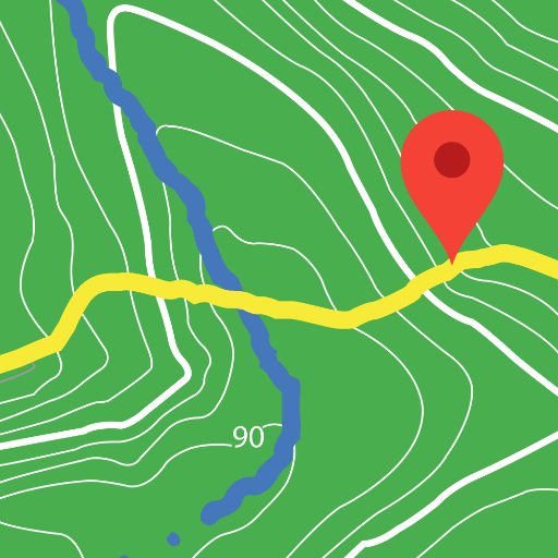
About topo (topographic) maps: Topo maps show terrain through color and contours, and are useful for navigation offroad. Topo maps and GPS can be used for hiking, hunting, kayaking, snowshoeing, & backpacker trails.
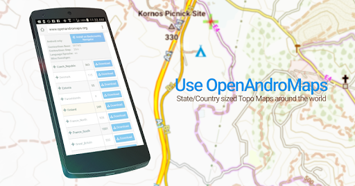
You can create your own maps with Mobile Atlas Creator, or specify a custom tile server. Built in sources include:
OpenStreetMaps from MapQuest
OpenCycleMaps showing terrain worldwide
US Topo Maps from Caltopo and the USGS
USTopo: Aerial Photography with markup.
Canada Topo Maps from Toporama
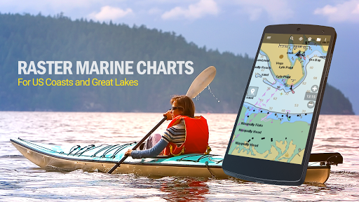
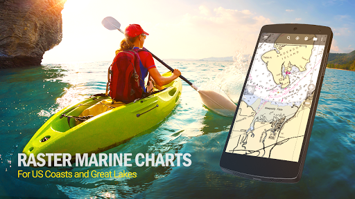
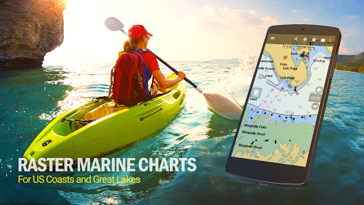
Marine maps: NOAA RNC Nautical Charts (coastal)
USGS Color Aerial photography
Topographic Maps of Spain and Italy
Topo maps of New Zealand
Japan GSI maps.
Many of the above sources are generally free to use.
Use offline topo maps and GPS on hiking trails without cell service. The GPS in your Android phone can get its position from GPS satellites, and you don’t have to rely on your data plan to get maps. Have more fun and safe GPS navigation in the backcountry.
Use as a geocaching navigator by getting a pocket query as GPX.
Besides geocaching, use GPS for recording tracks and GPS waypoints on your trip, all the while tracking your GPS quest on topographic maps. It may replace your Garmin handheld GPS.
Here are some of the outdoor GPS activities BackCountry Navigator has been used for:
As a hiking GPS both on hiking trails and off trail.
Camping trips to find that perfect camping site or the way back to camp with GPS.
Hunting trips for hunting wild game in rugged areas.
Doing recon for a hunt or as your hunting GPS
Fishing: make it your fishing GPS.
Search and Rescue (SAR).
Trekking the Pacific Crest trail or other long term hiking.
Kayak and canoe treks on inland lakes and streams or marine, coastal waters.
Backpacker trips: using topo maps of wilderness areas and national forests for navigation on trails with the GPS in your rucksack or backpack.
Find your own ways to have fun in the outdoors. Be a maverick by venturing beyond cell service boundaries with your GPS. Become a pro at navigation with GPS for the outdoors.
BackCountry Navigator has been on WM devices and preloaded on the Trimble Nomad outdoor rugged device. This Android version is more flexible, featured, and fun. Create a memory with maps.
For a one time fee, this a great addition to the outdoor gear you bought at Cabelas, REI, or another outdoor store. Many have found the Android GPS in a phone or tablet to substitute for a Garmin GPS or Magellan GPS, such as the Garmin GPS units Montana, Etrex, or Oregon. Android can be your handheld GPS.
What's New
In-app purchases
$3.99 - $24.99 per item
Version Information
- Version
- 8.0.5
- Downloads
- 100K+
- Updated on
- Sep 6, 2025
- Released
- Jun 23, 2010
- Requires
- Android 5.0
Statistics
Google Play Rating History
Rating Distribution
Downloads Over Time
BackCountry Navigator GPS PRO has been downloaded times. Over the past 30 days, it averaged downloads per day.
Shaded area shows 30-day prediction based on historical trends
Historical data collection started recently. More data points will be available over time.
BackCountry Navigator GPS PRO - Google Play Rankings
Top Rankings
| Rank | Country | Category | List | Change |
|---|---|---|---|---|
| — |
Ranking History in
No ranking data available yet. Rankings are updated daily.
#10 in Top Paid Maps And Navigation in United States

#84 in Top Grossing Maps And Navigation in United States
 Send My Location - GPS Tracker
BackCountry Navigator GPS PRO
Send My Location - GPS Tracker
BackCountry Navigator GPS PRO
 SpotAngels Parking Map & Deals
#16 in Top Paid Maps And Navigation in Saudi Arabia

#16 in Top Paid Maps And Navigation in Pakistan
BackCountry Navigator GPS PRO users say on Google Play
 Neal Barrus
I've used this app for years for hiking, snowshoeing and skiing. Easy to use. Easy to download maps for future use offline. Tracks speed, time, altitude and other stats. Automatically saves tracks. I wouldn't go without it.
 Todd Silimperi
Great app! I happily paid $10 for the Pro version. I've taken 6-7 hour canoe trips and recorded my track the entire way, sampling every minute. No battery issues. C'mon Crittermaps, get a real outdoorsperson to completely overhaul the waypoint icons. There are way too many icons for urban places like "butcher" and "theater", and the icons for REAL usable outdoor places are poorly done. And you should add a Google Drive backup feature for people who don't use DropBox.
 Dan Cole
OK, I bought an even newer Samsung Galaxy and it tells me it isn't compatible with it, it was still working fine on the Tab 3 (finally gave up) but not compatible with the Tab 4. Makes no sense to me. I cant even find requirements on their site... **I've used this for a good while and have had great luck with it on my Samsung Tab 3 7.0. Its dang accurate and shows you off trail pretty quick if you get turned around! I am curious however, does BCN work with GPX files such as those from Funtreks?
 Rob Richardson
Ok. I use Thunderforest maps a lot, particularly open cycle map, and they recently stopped working, going behind a paywall. I paid the subscription but they still don't work. The map just shows the base map with none of the open cycle map overlay. Can I have my subscription money back if it's not going to work‽
 Larry Hogston
The best mapping and GPS app on the market. It has worked flawlessly for years and I push it to it's limits. I keep it on when out exploring and/or metal detecting and have saved all my tracks and waypoints with related photos for years. So easy to use and customize. UPDATE: Due to changes in the Android system and the failure of support to address the issue you can no longer choose a photo located in another folder to associate it with a waypoint. 10 years of work down the drain.
ApkTrusted Ratings & Reviews
More from Nii Game INC
See more apps
Similar Apps

GPS Navigation Route Planner
Paid
Trails Offroad: Offline Maps
Free

HiiKER: The Offline Hiking app
Free

VesselFinder
Free

Gaia GPS: Offline Trail Maps
Free

Bike Route Planner
Paid

Holland America Line Navigator
Free

BaseMap: Hunting Maps and GPS
Free

Wanderz - Travel Guides
Free

GPS Essentials
Free

Gaggle Paragliding, Ultralight
Free

Multi-Stop Route Planner
Free

DeRadar
Paid

Orca: Boat GPS, Charts, Routes
Free

FarOut
Free

Avenza Maps: Offline Mapping
Free
Scan this QR code to download

Forwarding you to the page at Google Play market in seconds...
Open Google Play market now