Fishing Points-Lake Depth Maps v248.0
Gps Nautical Charts


About this app
Developer Description
Fishing Spots, Marine/ Nautical Charts, HD Sonar Maps w/ Tides, Marine Weather
First Fishing GPS app to have route assistance with Voice Prompts for marine navigation. You can create new boating routes or import existing GPX/KML routes. It supports Nautical Charts course up orientation. Includes Tide & Currents prediction.
► FISHING AI
Emulates an expert angler. It is trained to include multiple variables.
√ Lake bathymetry/topography
* Point Bars
* Humps / Underwater Islands
* Channels
* Saddles
* Artificial / Man Made Structures
* River Bed
* Ledges
* Side Feeder Streams
* Pits
* And more...
√ Local Knowledge for a lake gained over the years about likely hot spots
√ Weather Patterns
√ Vegetation Maps
√ Fish Type
►Vexilar Sonarphone
√ Adjustable height Sonar Split Screen
√ Sonar Logging
►FEATURES
√ Beautiful & detailed Hardware/GPU accelerated vector charts (text stays upright on rotation)
√ Long press to query the details of Marine object (Buoy,Lights,Obstruction etc).
√ Customizable depth(Ft/Fathom/Meter) & distance units(km/mi/NM)
√ Customizable Shallow Depth.
√ Record tracks,Autofollow with real-time track overlay & predicted path vector.
√ Voice Prompts for marine navigation (requires GPS )
√ 1ft / 3ft depth contour maps for anglers for selected lake maps.
√ Supports GPX/KML for boating route editing/import.
√ Tide & Currents prediction.
√ Seamless chart quilting of marine charts
√ Enter or import Waypoints.
► MAPS
It includes unlimited updates for 1 year.
√ Lake Maps & Nautical Charts with Fishing Points covering US, UK, Canada,Germany, NL, AU etc.
► Lake Temperature Maps
√Accurate to 1F (0.5 C)
►ROUTE MANAGEMENT / TRIP PLANNING
√ Create New Route/Edit Existing Routes
√ Move Points
√ Add points to an existing route leg
√ Delete / Rename points
√ Import GPX,KML & KMZ files
√ Plot/Edit Routes
√ Enter Waypoints
√ Share/Export Routes,Tracks&Markers
√ Reverse Routes
►GPS FEATURES
√ Auto Follow
* Real Time Track Overlay
* Predicted Path Vector
* Course Up(Text stays upright)
* Speed & Heading
√ Route Assistance With Voice Prompts
* Prompts when approaching a boating route marker
* Continous distance & ETA updates
* Alerts when sailing/boating off route
* Alerts when boating in wrong direction
√ Record Tracks
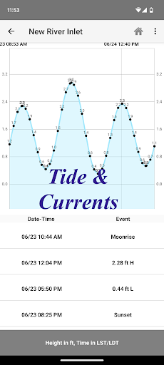
►TIDE & CURRENTS
* For US, Canada, UK, Germany & New Zealand
* High/Low Tides
* Tidal Current Prediction
* Active Current Stations
► SHARING
* Share tracks/routes/markers on Facebook & Twitter
* Export tracks/routes/markers as compressed GPX files.
Sample Charts
√ KISSIMMEE, Lake Apopka, ISTOKPOGA, SEMINOLE, TOHOPEKALIGA, Lake Tohopekaliga, HARRIS, Lakeocklawaha,
√ East Lake Tohopekaliga, Bighenderson, GRIFFIN, MONROE, TALQUIN, Lake Eustis, EUSTIS, WEOHYAKAPKA,
√ ORANGE , HARNEY, MICCOSUKEE, HATCHINEHA, SANTA FE SWAMP, Farm 13 Stick Marsh, Weir,
√ LOCHLOOSA , Crooked Lake, MARIAN, DEER POINT , HANCOCK, ROSALIE,
√ DORA, POINSETT, CROOKED , SANTA FE , RIVER STYX, Lake Yale,
√ YALE, CYPRESS , Lake Louisa, KERR, ARBUCKLE, PIERCE, June, JACKSON, PANASOFFKEE,
√ ALLIGATOR , DOCTORS , REEDY , OKAHUMPKA SWAMP, Jackson, Forest North, ROUSSEAU, MARION,
√ WASHINGTON, JOHNS , TARPON, Lake Minnehaha, HAMILTON, WOODRUFF, TIGER ,
√ DEXTER, PARKER, SAMPSON, COBB MARSH, Lake Minneola, GENTRY, DORR, BUTLER, Kingsley,
√ WINDER, TRAFFORD, BUFFUM, Josephine, TIBET, CLINCH, OKAHUMPKA,
√ LITTLE SANTA FE , ELOISE, Cherry Lake, BEAUCLAIR, MATTIE, CONWAY, SOUTH ,
√ OTTER SLOUGH, Bigsand, ASHBY, ARIANA, Hampton, CYPRESS CREEK, JULIANA
What's New
- Edge to Edge Immersive mode for Fishing Maps
- AIS enhancements
MAJOR UPDATE:
- Live Split Screen Sonar for Vexilar Sonarphones
- Sonar Logging
In-app purchases
$0.99 - $64.99 per item
Version Information
- Version
- 248.0
- Downloads
- 10K+
- Updated on
- Dec 31, 2025
- Released
- Aug 18, 2012
- Requires
- Android 5.0
Statistics
Google Play Rating History
Rating Distribution
Downloads Over Time
Fishing Points-Lake Depth Maps has been downloaded times. Over the past 30 days, it averaged downloads per day.
Shaded area shows 30-day prediction based on historical trends
Historical data collection started recently. More data points will be available over time.
Fishing Points-Lake Depth Maps users say on Google Play
 A Google user
Great application for maps ,flexibility would like to see a simulator section that would calculate various boating need such as alerts for weather ,fuel of distance best route to take etc .
A Google user
It's a great app, the maps are very detailed. Be sure to know at least a little about marine rules before hand.
A Google user
It seems to freeze a lot while in use. I had to buy the app for a second time because it said I did not have the pro. Very irritating.
A Google user
But they have made the Detroit river a hot mess. Lots of missing detail important to safe navigation (underwater obstructions and pilings) and lots of F(null)R and stuff like that. Would be not an issue if I could switch back to the official charts when I need them. Downloaded another app to get that functionality back. (Correction: They're there, they're just barely possible to see when you're outside because there's about zero contrast, rendering them absolutely pointless. I sent emailed pictures with rough lat longs comparing the difference between the competing app and this one to their support team)
A Google user
DO NOT BUY!!!!!!! i purchased this app about a year ago for $20. pulled my tablet out of the boat today to get it ready for the spring the app will not work without an update and you have to purchase the update. they disabled most of the features on the old version so it's basically useless total BS. i talked to a friend of mine he had the same problem
ApkTrusted Ratings & Reviews
More from Gps Nautical Charts
See more apps

Scan this QR code to download

Forwarding you to the page at Google Play market in seconds...
Open Google Play market now