
My Track v8.3.1
Daniel Qin


About this app
Developer Description
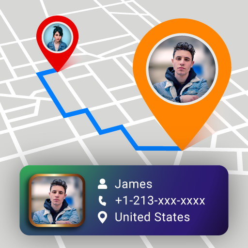
Plan a route, record, share and follow. Photos can be joined and shared.
My Track can be very useful for all of your outdoor activities like hiking, bicycle and motorcycle touring, boating, skiing, climbing or sheer driving fun, it can also be used for business.
Have a look at all of these fancy features:
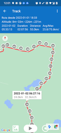
1. Record a route
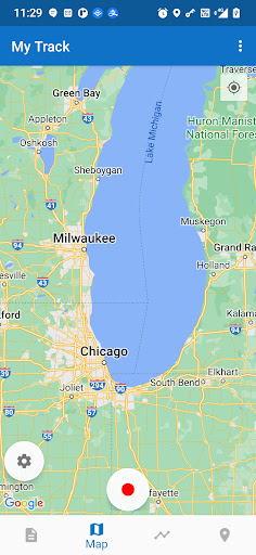
1.1 show current location on Google Map, along with time, duration and distance. even with latitude and longitude.
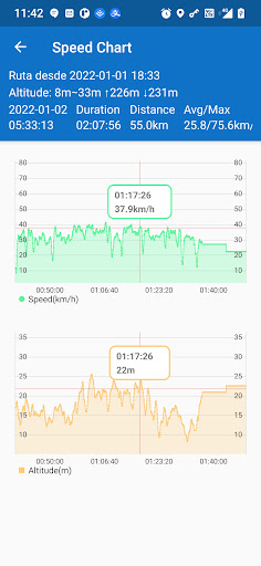
1.2 dynamic chart about speed and altitude.
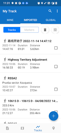
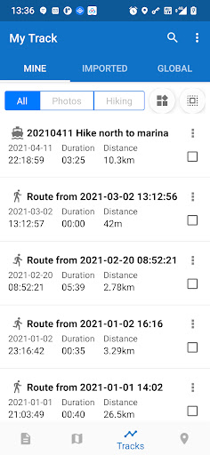
1.3 route recording, pausing, resuming, saving and listing.
1.4 photos joining with a route automatically, whatever app you use to take photos.
1.5 voice report at predefined frequency of time or distance when recording
1.6 export routes to GPX/KML/KMZ files, or import from your phone or Google Drive.
1.7 sync and restore from Google Drive.
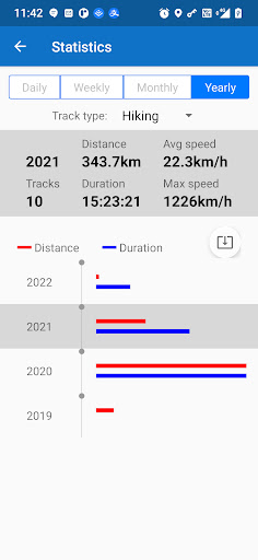
1.8 do stats.
1.9 show multi routes on the map.
1.10 print a route with the map.
2. Share a route
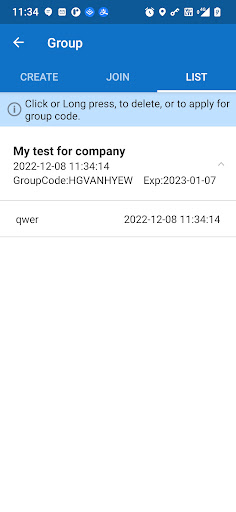
2.1 create a group and invite friends to join this group, you and your friends can share routes in this group.
2.2 share a route globally in this app.
2.3 share a route via web url to social medias, like WhatsApp, FaceBook, Gmail, etc.
2.4 select photos to share with a route.
3. Follow a route
3.1 follow your own route.
3.2 follow others’ shared route.
3.3 follow planned route.
3.4 fly your imagination: share a route in a group, friends in this group can follow this route.
4. Plan a route
4.1 plan a route(driving, bicycling and walking) among multi markers, the planed route can be followed on the map.
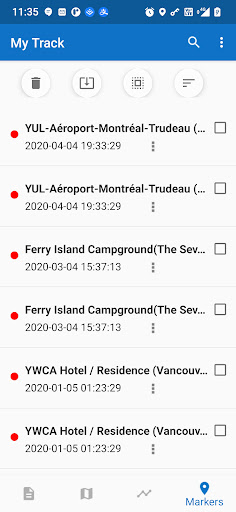
5. Markers
5.1 tap on the map to insert a marker, move the map to put the marker on proper position.
5.2 select markers to show on the map.
5.3 markers can be remembered to show next time when you open the app.
5.4 markers can be shared or exported within a route.
5.5 export markers to a KML file.
6. More
6.1 Live broadcast your locations to friends.
6.2 download offline map.
6.3 add map layer, and auto load this layer when the app starts.
6.4 click the map to measure distance, measure area, or to connect points to design a route line.
The app needs such permissions:
1. Storage permission for route saving.
2. Photo permission for joining photos with a route.
3. Location permission for route recording.
4. Internet permission for route sharing.
Attention:
1. Google Play and Google Maps should be installed first.
2. All basic features are free forever.
3. After 15 days you may see ads, you can pay to remove ads forever.
4. After 60 days you may subscribe to advanced features, or watch a video to get one time's feature permission.
What's New
1. Enhanced Marker
Markers can be added to any saved route, marker labels can be set to show below markers.
2. Enhanced Voice
In a route recording , two voice reminders can be enabled in the settings:
- Periodic voice reminder about duration and distance,
- Alarm distance from markers can be set to remind.
A third voice reminder has been available in earlier releases. When following a route, a buffer zone around the route and an out-of-range alarm can be set. This is useful for racing.
In-app purchases
$0.99 - $19.95 per item
Version Information
- Version
- 8.3.1
- Downloads
- 1M+
- Updated on
- Sep 3, 2025
- Released
- Feb 19, 2014
- Requires
- Android 6.0
Statistics
Google Play Rating History
Rating Distribution
Downloads Over Time
My Track has been downloaded times. Over the past 30 days, it averaged downloads per day.
Shaded area shows 30-day prediction based on historical trends
Historical data collection started recently. More data points will be available over time.
My Track - Google Play Rankings
Top Rankings
| Rank | Country | Category | List | Change |
|---|---|---|---|---|
| — |
Ranking History in
No ranking data available yet. Rankings are updated daily.
#93 in Top Grossing Travel And Local in United States


#14 in Top Grossing Travel And Local in Brazil

#26 in Top Grossing Travel And Local in Philippines

#27 in Top Grossing Travel And Local in South Korea

My Track users say on Google Play
 Sarah Nevin
I've been using this app for years and I use it daily for hikes. It is extremely accurate and when compared with other people who use different apps while hiking with me, it is always more accurate. I will be buying a subscription now because you can't export kml files for free anymore and that is fine with me. Completely worth the cost because the developer, Daniel, has always been quick to respond and resolve any issues in a timely manner and he keeps making sure this app stays updated!
 Roger B.
I love this app and have been using it for many years. I deducted one star because of the details page lists altitude in meters and speed (average & max) in km/h. Also, the distance meter on the map list distances in meters. I've tried to switch it to mi/hr and feet to no avail in the settings. All of the other readings are correct in mi/hr and feet. If this was corrected, I would definitely rate this five stars!
 To Gary
i have renew my credit card and paid. I am still unable to edit and backup my tracks
 Kritter Robin
I am a premium annual member. My app stopped working. It does not load at all. However, sharing my trip show advertisements even though I am a premium member. If I am paying for premium service then why do my followers have to see ads? This should be removed as that is what you would expect from a premium subscription. So please remove the ads on sharing the location. It scare people to see these ads when all that they want to do is follow my trips.
 Jeremy Davis
I've had this app for years and am using it again for bike riding. My gripe is that now it requires a subscription for things that used to be free. Such as mph or elevation during my ride(no graphs available without subscription). It posts total elevation or mph average but I cannot see it throughout ride. edit after response: no i will no longer use this app due to it now charging for graphs. I have switched apps due to me liking the charts to identify my speed with elevation.
ApkTrusted Ratings & Reviews
More from Daniel Qin
See more apps
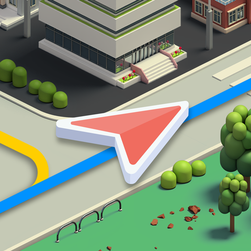
Similar Apps
Geo Tracker - GPS tracker
Free
Karta GPS Offline Maps Nav
Free
Save Location GPS
Free

Magic Earth Navigation & Maps
Free
OsmAnd — Maps & GPS Offline
Free
WhatsGPS
Free
My Location - Track GPS & Maps
Free

MAPS.ME: Offline maps GPS Nav
Free
Offline Map Navigation
Free
Multi-Stop Route Planner
Free
Sygic GPS Navigation & Maps
Free

Compass & Altimeter
Free
Bikemap: Cycling Tracker & GPS
Free

Avenza Maps: Offline Mapping
Free
AlpineQuest Explorer Lite
Free

HiiKER: The Offline Hiking app
Free
Scan this QR code to download

Forwarding you to the page at Google Play market in seconds...
Open Google Play market now