Rivercast - River Levels App v3.43
Juggernaut Technology, Inc.


About this app
Developer Description
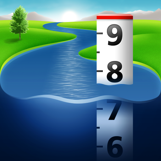
Storm on the way? Hitting the water? Track river levels and forecasts near you!
Whether you’re a boater, paddler, property owner, or just curious about your local waterways, Rivercast makes it easy to see exactly what’s happening on the rivers that matter to you.
Rivercast includes:
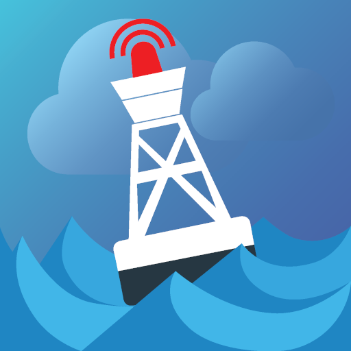
• Official flood warnings and alerts from the National Weather Service
• River stage height in feet
• River flow rate in CFS (when available)
• Color indicators showing when a river is normal, rising, or flooding
• Current observations and recent history
• Custom push notification alerts when a river reaches your chosen level (subscription required)
• NOAA river forecasts (when available)
• Interactive map showing all nearby river gauges
• Search by waterway name, state, or NOAA 5-digit station ID
• Zoomable, pannable, interactive graphs
• Add your own reference lines for landmarks or safety levels
• Favorites list for quick access to your key locations
• Share your graphs via Text, Email, Facebook, etc.
• Home Screen Widget to monitor your favorite locations at any time.
Rivercast’s map not only shows where gauges are located, but color-codes them to indicate whether each station is at normal levels, approaching flood stage, or above flood stage.
Tap any location to view the latest observations or open an interactive graph for detailed trends. Pinch or drag to zoom and pan, or tap and hold for precise readings using the crosshair tool.
Customize your hydrographs with personal level markers for bridges, sandbars, rocks, or safe navigation levels. Add favorite gauges for quick monitoring anytime.
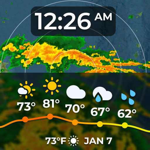
Rivercast uses official NOAA observation and forecast data and requires an internet connection for data access. Data is displayed in feet or cubic feet per second (CFS) when available, always shown in your local time.
A trusted tool for boaters, fishermen, property owners, paddlers, scientists, and marine professionals who need clear, reliable river information.
River gauges reported are USA only.
We take our accuracy seriously!
* * * * * * * * * * * * * * * * * * * * * * *
Some Frequently Asked Questions:
Where does Rivercast get its data?
This app uses NOAA sources for its raw data for our custom graphing and mapping solutions. Some locations available only from other agencies (such as USGS) may not appear in this app.
Why does Rivercast sometimes show slightly different flow data (CFS) than USGS?
CFS is a calculated estimate derived from stage height. NOAA and USGS use different data models, so results can vary slightly—usually within a few percent. Stage height is always identical between NOAA and USGS, and designated flood stages are based on height in feet.
Why does Rivercast only show observations, but not forecasts, for my river?
NOAA provides forecasts for many, but not all, monitored rivers. Some forecasts are seasonal or only issued during high-water events.
My river gauge was there yesterday, but it’s gone today. Why?
River gauges occasionally have technical issues transmitting data or may even be washed out during flooding. Some are also seasonal. NOAA typically restores data within a few days or weeks.
Can you add location XYZ to your app?
We wish we could! If NOAA doesn’t report data for that location, we unfortunately can’t include it. Rivercast displays all stations that NOAA provides for public use.
Notice: Raw data used in this app is sourced from www.noaa.gov.
Disclaimer: Rivercast is not affiliated with or endorsed by NOAA, USGS, or any other government entity.
What's New
If you have any questions, problems, or comments, please email us at help@RivercastApp.com!
And if you like Rivercast, please consider supporting it by leaving a Favorable Review or Upgrading to Premium!
In-app purchases
$9.99 - $39.99 per item
Version Information
- Version
- 3.43
- Downloads
- 10K+
- Updated on
- Jan 4, 2026
- Released
- Nov 21, 2020
- Requires
- Android 11
Statistics
Google Play Rating History
Rating Distribution
Downloads Over Time
Rivercast - River Levels App has been downloaded times. Over the past 30 days, it averaged downloads per day.
Shaded area shows 30-day prediction based on historical trends
Historical data collection started recently. More data points will be available over time.
Rivercast - River Levels App - Google Play Rankings
Top Rankings
| Rank | Country | Category | List | Change |
|---|---|---|---|---|
| — |
Ranking History in
No ranking data available yet. Rankings are updated daily.
#92 in Top Grossing Weather in United States
Rivercast - River Levels App users say on Google Play
 Joe W
Joe W
I use this app to keep an eye on river levels before and during float trips. Great app. The only thing that would make it better is if i could set an alert on my favorites so if a river went over a certain level i would get a push notification. Still 5 stars
 Brent Davis
Good access to the data. Not optimized for users that want to track levels on a number of rivers over a large geographic area at a glance.
 David Marr
It's ok
 Margo Kirk
Great if you want to see right now, BUT gives no indication of what was before. Like past week or so. So you can watch weather and guess at what your in for. Disappointed 😞.
 Wes Litsey
Terrible. Rather than pay for premium, i bookmarked a browser page to my desktop from the noaa site. How stubid would someone have to be to pay for this?
ApkTrusted Ratings & Reviews
More from Juggernaut Technology, Inc.
See more apps
Similar Apps

Deep Dive - Bass Fishing App
Free
BassForecast: Fishing Forecast
Free

Emergency: Severe Weather App
Free
NOAA Weather Unofficial (Pro)
Paid
Water Country USA
Free

Chargeway
Free

The Salt Lake Tribune
Free

Local 10 - WPLG Miami
Free
FOX10 Weather Mobile Alabama
Free

ClickOnDetroit - WDIV Local 4
Free

Harley-Davidson
Free

ATMOS : Online dive logbook
Free
St. Cloud Live StormTRACKER
Free
Rain Bird Resources
Free

MotorTrend
Free

BISSELL Connect
Free
Scan this QR code to download

Forwarding you to the page at Google Play market in seconds...
Open Google Play market now