Alpe Adria Trail vVARY
Outdooractive AG
About this app
Developer Description
The perfect app for the Alpe Adria Trail !
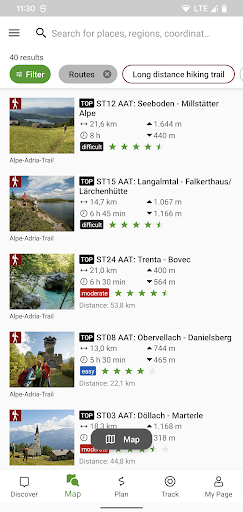
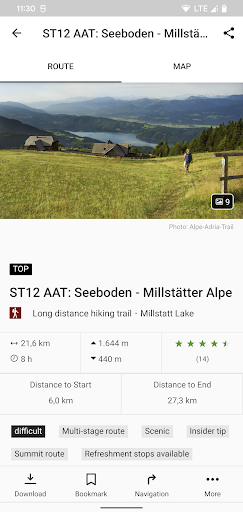
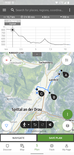
An essential component of the app is the detailed information that is provided for each stage: the course of the stages, attractions and establishments.
The tours/stages, including all tour details and relevant map sections, can be stored on a smartphone and can be accessed offline, if required (for example, if you are in another country, in areas with weak network coverage, or when data roaming would be too expensive).
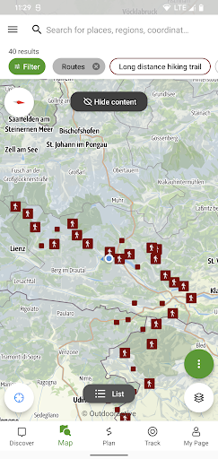
The tour descriptions contain all the facts, images and elevation profiles you might need. As soon as a tour is started, you can determine your own position (including determining which direction you are facing) easily in the topographic map and, in this way, follow the course of the route.
Please note: In other countries high roaming costs can occur, therefore, when using the app, make sure all necessary information can be accessed offline by downloading it at a flat rate or via Wi-Fi before starting your journey.
Background use of the app with activated GPS reception can drastically shorten battery life!
Version Information
- Version
- -
- Downloads
- 10K+
- Updated on
- -
- Released
- Feb 8, 2022
- Requires
- Android Varies with device
Statistics
Google Play Rating History
Rating Distribution
Downloads Over Time
Alpe Adria Trail has been downloaded times. Over the past 30 days, it averaged downloads per day.
Shaded area shows 30-day prediction based on historical trends
Historical data collection started recently. More data points will be available over time.
Alpe Adria Trail users say on Google Play
 Ruben Thijs
This app is a life saver high up in the mountains. Easy detailed offline map. It can be improved (a lot) on several points, but used solely as a digital map to navigate it is brilliant in it simplicity.
 Philipp Z
It's an Outdooractive wrapper, with usual pros and cons. Other maps are better for following the trail, like openandromaps in locus.
ApkTrusted Ratings & Reviews
More from Outdooractive AG
See more apps
Outdooractive. Hike and Ride
Free

alpenvereinaktiv
Free

Edersee | Deine Region!
Free

E-MOB: e-MTB at Trás-os-Montes
Free

Ain outdoor
Free

Anii Drumetiei
Free

Amazon of Europe Bike Trail
Free

Rail & Trail
Free

Outdooractive Audio Guide
Free

Swabian Alb Association
Free

Explore Falkland Islands
Free

Val Gardena-Gröden Outdoor
Free

Visit Herefordshire
Free

Thüringer Hofläden entdecken
Free

Erlebnis Nationalpark
Free

Hydra Trails - Hiking Guide
Free
Scan this QR code to download

Forwarding you to the page at Google Play market in seconds...
Open Google Play market now