
Outdooractive. Hike and Ride vVARY
Outdooractive AG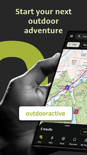


About this app
Developer Description
Find, plan & track your outdoor adventures with reliable maps trusted by experts
The Outdooractive - Hike and Ride app helps you find officially approved routes near you and around the world, with suggestions for dozens of sports including: hiking paths, trekking trails, mountain biking routes, trail running paths, ski touring routes and more. Or plan your own routes using the deepest catalog of official maps to take adventures into your own hands.
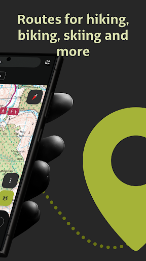
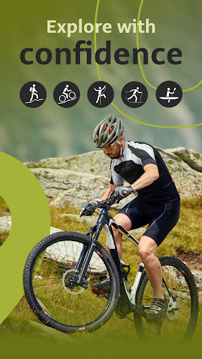
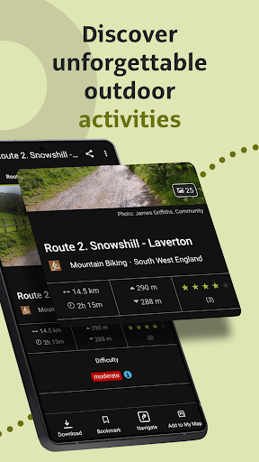
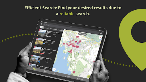
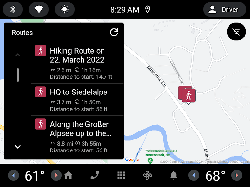
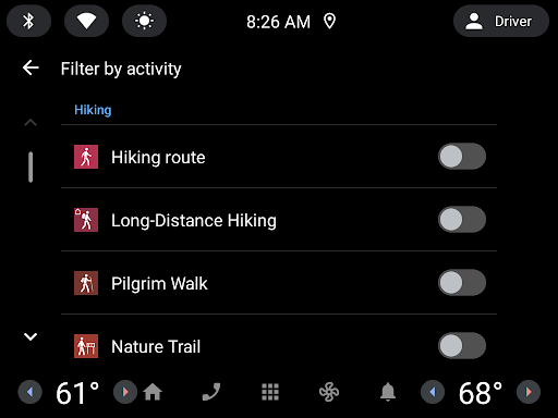
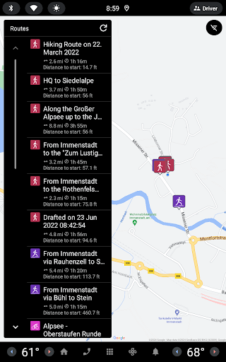
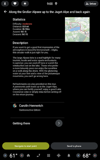
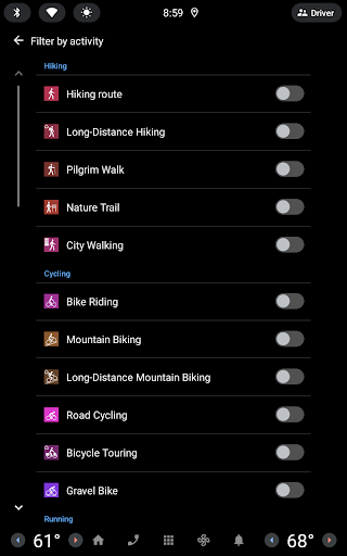
● Find routes you can rely on: Browse thousands of officially-approved routes near you and across the world, including routes for hiking, road cycling, bike touring, ski touring, gravel riding, trail running, horseback riding, mountaineering and more.
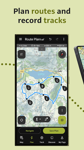
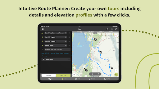
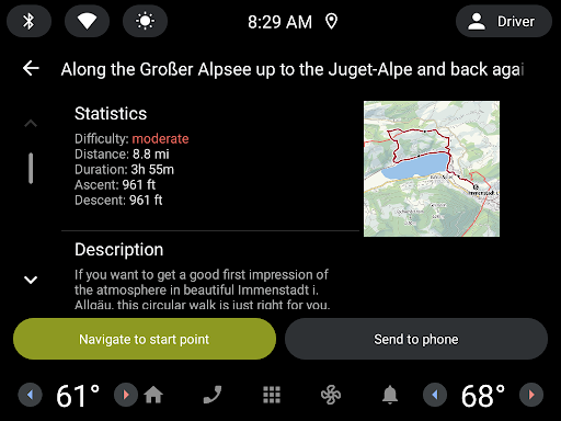
● Plan your own routes with tools trusted by professionals: Easily plot your own outdoor routes in the route planner in just a few taps, and see all need to know distance, elevation and terrain info.
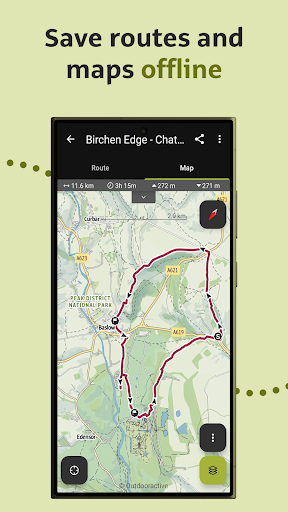
● Save everything offline: Save individual plans or entire areas offline for reliable navigation when you don't have a phone signal.
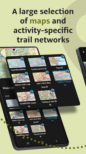
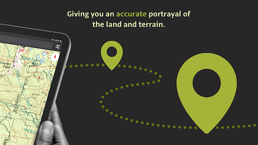
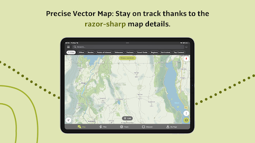
● Navigate with the most reliable maps on the planet: Browse the deepest collection of different map types to track or plan your adventures with confidence. Simply switch between different layers to get a clearer picture of the terrain you're planning to visit, and get the most reliable understanding of conditions on the ground. Outdooractive's map catalog currently includes:
- Official topo maps in 25 countries, including:
• Ordnance Survey (Landranger & Explorer) in the United Kingdom
• New Zealand Land Information in NZ
• USGS in the USA
• BKG in Germany
• BEV in Austria
• Swisstopo in Switzerland
• IGN in France
• CNIG in Spain
• PDOK in the Netherlands
• Kartverket in Norway
• Kortforsyningen in Denmark
• Lantmäteriet in Sweden
• Finland National Land Survey in Finland
• GSI in Japan
• Harvey Maps in the UK's most mountainous areas
- The official Alpine Club maps for climbing in the Alps
- The specially-designed Outdooractive map across France, Germany, Austria and Switzerland.
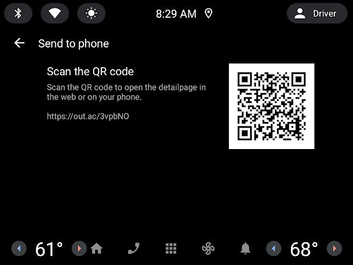
● Share your live location with family and friends: Give yourself and your loved ones complete peace of mind when you're out in the great outdoors thanks to BuddyBeacon.
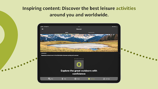
● Join a global community of outdoor tourists and adventurers: Share your activities with the community, join challenges to stay motivated, and get inspired by officially-approved content from our thousands of industry partners.
● Smartwatches with WEAR OS from Google: With a glance at your Smartwatch, you get information about your GPS position on the map. You can record tracks, get tracking data and navigate along routes.
FAQs:
Can Outdooractive find walking trails near me?
Outdooractive helps you find walking, hiking, cycling and many more types of trails both in your area, and around the world.
How can I find hiking trails near me?:
Using Outdooractive, you're able to find hiking trails in your local area by opening our app and browsing the map. You'll be able to see hiking trails with a range of distances, difficulties and distance from your location.
How do I know which hiking trails close to me are best to follow?:
Using Outdooractive's multiple map layers, you're able to view official information from multiple sources, to inform you about trail conditions, rules, restrictions and what to expect on your hike. Experts will share information on each route on its difficulty, required experience level and more!
Can I download offline maps to navigate nature walks and areas to hike near me?:
Outdooractive allows you to download maps and routes to your device before heading out, to help you navigate those areas where signal isn't guaranteed — allowing you to reliably navigate the outdoors.
What's New
Do you have any questions or suggestions? Shoot us an email to service@outdooractive.com
Your Outdooractive Team
In-app purchases
$0.99 - $69.99 per item
Version Information
- Version
- -
- Downloads
- 1M+
- Updated on
- Jan 16, 2026
- Released
- Aug 16, 2018
- Requires
- Android Varies with device
Statistics
Google Play Rating History
Rating Distribution
Downloads Over Time
Outdooractive. Hike and Ride has been downloaded times. Over the past 30 days, it averaged downloads per day.
Shaded area shows 30-day prediction based on historical trends
Historical data collection started recently. More data points will be available over time.
Outdooractive. Hike and Ride - Google Play Rankings
Top Rankings
| Rank | Country | Category | List | Change |
|---|---|---|---|---|
| — |
Ranking History in
No ranking data available yet. Rankings are updated daily.
#2 in Top Grossing Travel And Local in United Kingdom


#2 in Top Grossing Travel And Local in Italy
#5 in Top Grossing Travel And Local in Germany

#6 in Top Grossing Travel And Local in Egypt

Outdooractive. Hike and Ride users say on Google Play
 Katrin Duffill Telsnig
Outdooractive has OS maps and makes it really easy to use them. You can plan routes and the plotting line snaps to the footpaths. You can also look at other routes people have plotted and posted publicly, which is great for a new area. The blue dot showing where you are and which direction you are facing is brilliant. I use this for every walk and run.
 wayne b
I use the app and works reasonably well have problems with it freezing gps position on occasions but that may relate to my phone as need to reboot phone to get it working again. I really liked the planning tool ( reason I picked it over All trails app) but a recent update to ' improve ' it has made it overly complex and in my view worse than the older version. Not all change is good.
 John Strickland
It's ok, complicated, in planning regularly changing from paths on to paths off. Occasionally when walking in remote locations lose gps signal and it goes off at a tangent and then back again, but I've walked an extra 3 miles + in 3 minutes. Better than map my walk though. Have considered going back to OS maps to see if that's improved.
 Jon Moore
Have used another nav app for the last couple of years after being disgruntled about the lack of features that used to exist in Viewranger. Checked back recently and it looks like OA is still using GPS for calculating elevation stats instead of a DEM/terrain model and interpolation. Why? Surely with LiDAR models the latter would be far better. Still can't lock scale at 1:25k either. Still no two decimal places for distance stats. Still no seconds shown in timings (important if you're a runner)
 John Hockenhull
APP STILL BROKEN. Update in last 24 hours has not fixed the distance and other stats fault. Outdooractive's purpose is to accurately record hiking and riding activity. it is failing to do this. YOU BROKE THE APP Your recent update created a bug and the app no longer records distance and speed correctly. Example of. 45 minute circular walk. Time downhill 10 mins, time uphill 2 mins, time on the flat 32 mins. Total time spent moving 11 mins. Average walking speed 12.6 miles per hour.
ApkTrusted Ratings & Reviews
More from Outdooractive AG
See more apps
alpenvereinaktiv
Free

Edersee | Deine Region!
Free

Val Gardena-Gröden Outdoor
Free

Alpe Adria Trail
Free

Ain outdoor
Free

Anii Drumetiei
Free

Amazon of Europe Bike Trail
Free

Swabian Alb Association
Free

E-MOB: e-MTB at Trás-os-Montes
Free

Rail & Trail
Free

Explore Falkland Islands
Free

Outdooractive Audio Guide
Free

Visit Herefordshire
Free

Thüringer Hofläden entdecken
Free

Erlebnis Nationalpark
Free

Hydra Trails - Hiking Guide
Free
Similar Apps

Gaia GPS: Offline Trail Maps
Free

swisstopo
Free

HiiKER: The Offline Hiking app
Free

Mapy.com: Offline hiking maps
Free

bergfex: Hiking & Tracking
Free

PeakVisor - 3D Maps & Peaks ID
Free
Trailforks
Free

komoot - hike, bike & run
Free

OsmAnd — Maps & GPS Offline
Free

Cyclers: Bike Navigation & Map
Free

Polarsteps
Free

Wikiloc - Trails of the World
Free

Footpath Route Planner
Free

AllTrails: Hike, Bike & Run
Free

Bikemap: Cycling Tracker & GPS
Free

Map My Ride With GPS Tracker
Free
Scan this QR code to download

Forwarding you to the page at Google Play market in seconds...
Open Google Play market now