
swisstopo v1.21.0
Federal Office of Topography swisstopo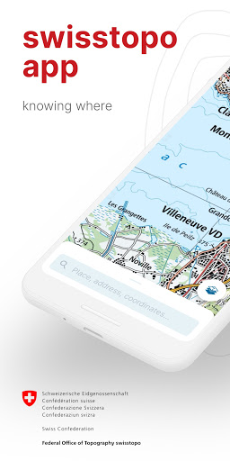


About this app
Developer Description
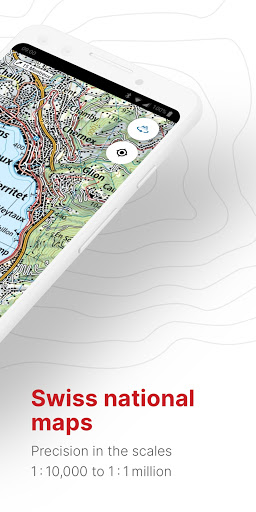
Official Swiss Maps
Use the famous national maps to discover even the most remote places in Switzerland and topics such as hiking, cycling, snow sports and aviation. All functions and data of the app as well as offline use are free of charge. The app is free of advertising and does not require a login.
- all scales from 1:10 000 to 1:1 million
- current aerial image and historical maps
- official hiking, mountain hiking and alpine hiking trails
- closures of hiking trails
- snowshoe and ski routes
- SwitzerlandMobility routes
- public transport stops
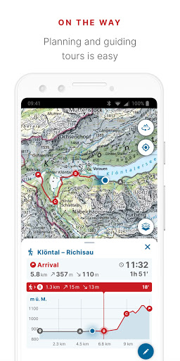
ON THE ROAD
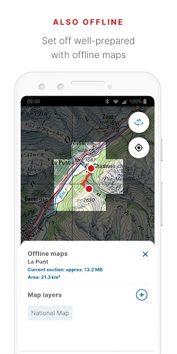
- free offline maps (1:25 000 to 1:1 million)
- draw, record, import and share your own tours
- set tour type (hiking, cycling, mountain biking) and personal pace
- tour guide (arrival time, remaining distance)
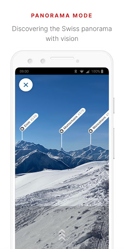
- panorama mode (labelled panorama, view tour in "3D")
- save markers, add notes, share
TOOLS such as measure, compare and search (for geographical names, addresses or coordinates)
Report changes to maps and geodata
AVIATION
- aeronautical charts, obstacles, airspaces
- landing sites
- restrictions for drones and model aircrafts
Do you have a question? Then write to us:
support-cd@swisstopo.ch
What's New
You have questions or feedback? Contact us by e-mail (support-cd@swisstopo.ch) or phone (+41 58 469 02 22).
Version Information
- Version
- 1.21.0
- Downloads
- 1M+
- Updated on
- Dec 10, 2025
- Released
- Jul 18, 2020
- Requires
- Android 8.0
Statistics
Google Play Rating History
Rating Distribution
Downloads Over Time
swisstopo has been downloaded times. Over the past 30 days, it averaged downloads per day.
Shaded area shows 30-day prediction based on historical trends
Historical data collection started recently. More data points will be available over time.
swisstopo users say on Google Play
 Gedeon Stol
Solid user experience and programming, this is how apps were supposed to be made. Includes offline maps, waypoint routing, storage and route tracking. No ads, no sneaky upsale strategy, no 3rd party tracking, no accounts to setup, just focused functionality, solid maps, and purpose. Thank you for making this.
 Julien Falco
Great app, but it's really struggling to download maps with a weaker network coverage. Update 24.10.2023: it's not that. It really wasn't able to download maps, even with good coverage. What I did instead: I removed and re-installed the app, and now it works. There must have been corrupted memory files or smth. It would be worth investigating the logs on your end. Pixel 5 phone. Thanks.
 Ronald Paul
wo ist die Legende / Zeichenerklärung?
 Daniel Meyer
I have used this app for quite some time like it a lot! One factor it sets it above competing apps is, that you always see the time left on your planned route which gets updated as you progress. But: In the last two months, the app crashes all the time when I have a route selected to follow it. It might be an issue related to zooming and relying on offline maps. I wasn't able to pinpoint it. I use version 1.11.0 on a Pixel 7 pro with Android 13.
 Firefox
Needs improvements
ApkTrusted Ratings & Reviews
Similar Apps

HiiKER: The Offline Hiking app
Free

Gaia GPS: Offline Trail Maps
Free
PeakVisor - 3D Maps & Peaks ID
Free
Navionics® Boating
Free

Orca: Boat GPS, Charts, Routes
Free

bergfex: Hiking & Tracking
Free

Outdooractive. Hike and Ride
Free

FarOut
Free

Magic Earth Navigation & Maps
Free

Bikemap: Cycling Tracker & GPS
Free

Cyclers: Bike Navigation & Map
Free

Guru Maps Pro & GPS Tracker
Free
Geo Tracker - GPS tracker
Free
PeakFinder
Paid

AlpineQuest Explorer Lite
Free

Skratch: Travel Map & eSIM
Free
Scan this QR code to download

Forwarding you to the page at Google Play market in seconds...
Open Google Play market now