Water Map Live - Routes, AIS v11.2
Surfcheck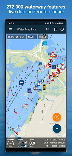


About this app
Developer Description
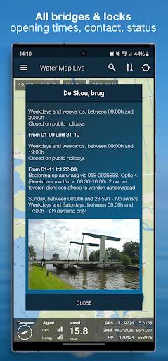
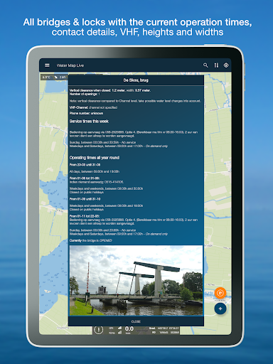
All bridges & locks, live shipping route info, water level, meteo, route planner
All water charts can be downloaded and used offline.
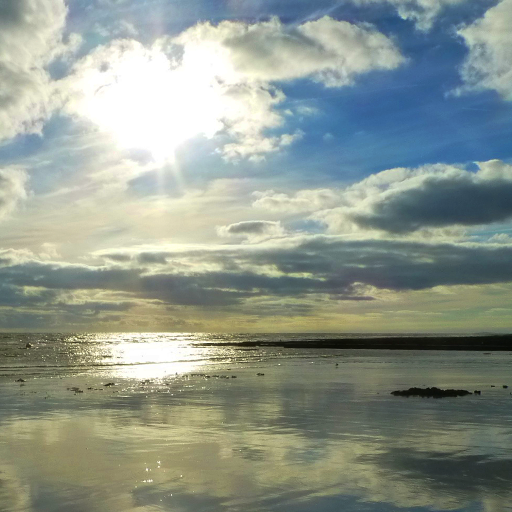
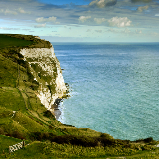
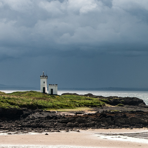
The app really is LIVE and contains hundreds of current water levels, tidal curves, the weather at sea and in your area, water depths, data from KNRM stations and the water quality of countless Dutch bathing places. And the current notices to skippers (NtS): are there any obstructions on your route? You know it now. Always up to date.
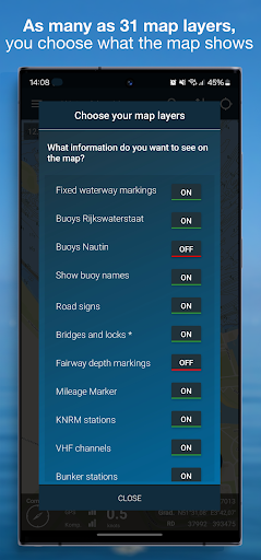
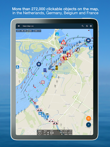
In total, the app contains the data of more than one hundred thousand nautical objects that are shown on the map around you. Thanks to GPS you can also read your speed and current coordinates. With the GPS tracker you can record and save your routes.
The app is based on map material from the Dutch Land Registry and also contains the beautiful 1: 25,000 topographical maps of the Netherlands.
Water Map Live is excellent for offline use, but the live information about bridges & locks, NtS, the current water levels and the current weather naturally uses an internet connection.
Also for Android Auto
The Android Auto app is an extension of Waterkaart Live that you can use if you have a suitable device. To keep the Android Auto app clear and above all fast, it displays the set of icons that are most important when cruising. It also displays your route planned in the app and the recommended sailing directions of shipping nodes.
Conditions.
We do our utmost to deliver a fantastic and accurate water map app, but of course we cannot guarantee that the software and the data presented therein will always work and are 100% correct. Data sources can sometimes change and you cannot derive any rights from this app or the information presented therein. Usage of course is on your own risk. By downloading and using this water map app you accept these terms and conditions.
Location
The location permission is only needed to show you the current location and related information in your area. Surfcheck does not use this location data in any other way.
What's New
- The base maps with water depths for the German Wadden Sea and Baltic Sea have been completely updated and are more complete than ever.
- The app now also includes current shipping weather reports and warnings from the Deutsche Wetterdienst (North Sea and Baltic Sea and coastal weather reports), Met Office (UK and Atlantic Ocean), Meteo France and HNMS (Mediterranean Sea).
In-app purchases
$4.49 - $8.99 per item
Version Information
- Version
- 11.2
- Downloads
- 100K+
- Updated on
- Jan 6, 2026
- Released
- May 14, 2018
- Requires
- Android 8.0
Statistics
Google Play Rating History
Rating Distribution
Downloads Over Time
Water Map Live - Routes, AIS has been downloaded times. Over the past 30 days, it averaged downloads per day.
Shaded area shows 30-day prediction based on historical trends
Historical data collection started recently. More data points will be available over time.
Water Map Live - Routes, AIS - Google Play Rankings
Top Rankings
| Rank | Country | Category | List | Change |
|---|---|---|---|---|
| — |
Ranking History in
No ranking data available yet. Rankings are updated daily.
#15 in Top Grossing Maps And Navigation in Netherlands
 Mapy.com: Offline hiking maps
Water Map Live - Routes, AIS
Mapy.com: Offline hiking maps
Water Map Live - Routes, AIS
 MapXplorer: Navigation, Radar
#78 in Top Grossing Maps And Navigation in Germany

Water Map Live - Routes, AIS users say on Google Play
 Emilio Sacchelli
i was looking for alternatives to the other known app as for my needs they charge too much and found this app which is just great. has all the same functions and i actually prefer the map layout especially with the topo map. make sure you discover the planning function which is a bit hidden under the menu accessible with the + button. suggestio to the makers, put the routing button on the main map page and allow users to move the points used in the route planning as sometimes we need to divert
 Casa Flor
I can't use as is only Dutch. Any chance you can add English? It looks a good application to navigate with a boat.
 Kiere Luurs
Tracking does not work at all (on Android 10). Even though my location is displayed and controls like Pause and Stop are active, no track is displayed on the map, no distance is displayed, no Previous track is displayed, and no data at all is to be found on my phone. It does not display a lot depths. What I do like are downloadable maps and clickable symbols. It is also handy to be able to search for a location. There is an option of 3 kinds of very usable maps with pretty much additional markings.
 A Google user
Geen brughoogtes, totaal onbruikbaar.
 Dave Martin
My tablet has 8 gb free. This app needs 1.2 gb for the charts, but refuses to download, saying that there is only 600MB available. It's a pity, because its really nice. On to the next one..
ApkTrusted Ratings & Reviews
More from Surfcheck
See more apps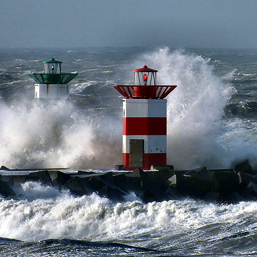
Zeeweer - Maritieme app
Free

Weer Nu - Weerbericht en Radar
Free
Weather in Holland: the app
Free
Ad Astra: Star Atlas
Free
Tidal stream atlas, English Ch
Paid
Tidal Stream Atlas, Dover
Paid
Tidal Atlas Irish Sea, Bristol
Paid
Stroomatlas Noordzee
Paid
The Tides - the Netherlands
Free

Tidal Stream Atlas France W.
Paid
Tidal Stream Atlas, Scotland
Paid
Tidal Stream Atlas, Thames Est
Paid
Topographical charts Holland
Free
Het Weer: de weerapp
Free
Weerwaarschuwing: Weeralarm NL
Free
Binnenvaartpolitiereglement
Free
Scan this QR code to download

Forwarding you to the page at Google Play market in seconds...
Open Google Play market now