
Mgrs & Utm Map Pro vVARY
DakikTech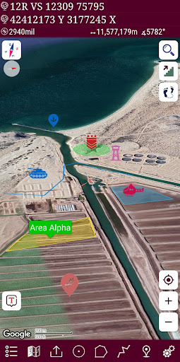


About this app
Developer Description
This app is military GPS coordinate systems helper. (MGRS, UTM & DMS Maps)
👉 More maps (Bicycle, Topographic, Neighborhood, Atlas etc.)
👉 You can see the altitude profile of your route on the chart
👉 You can search for locations by address
👉 You can create different layers for your different activities
👉 List view for markers, routes, areas and KML
👉 You can draw multiple routes and areas, and change their colors
👉 More and colorful pointer icons
👉 Name or icon display options for markers
👉 Multiple routes can be recorded with the GPS recorder
👉 And no ads
This application is GPS and coordinate systems helper especially for military personnel.
It is also a complete helper for mountaineering, trekking and hiking, cross running, scouting, hunting, fishing, geocaching, off-road navigation and all other outdoor activities and sports.
With satellite navigation systems such as GPS, GALILEO and GLONASS (GNSS) supported by your device and your sensors, you can see your most accurate position on different map layers.
Features:
* Easy and Faster
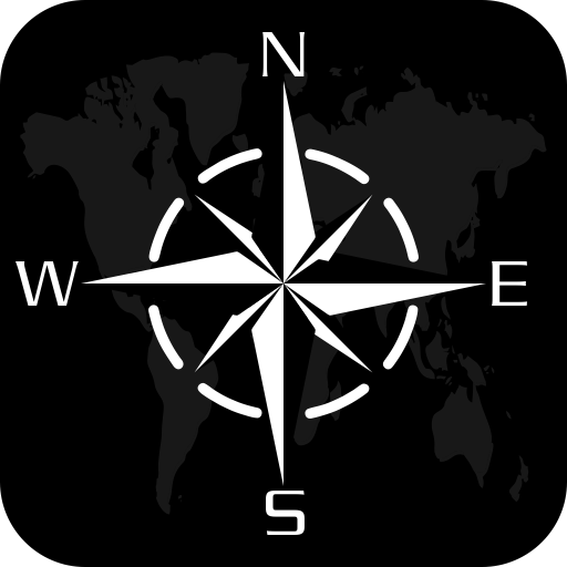
* Compass.
=> Compass on map (on the map that shows your direction)
=> Compass only (shows physical directions)
=> Angular units for compass (degrees, grad and mil)
* Follow Mode
=> The center of the map follows your location while on the move.
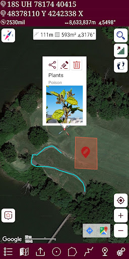
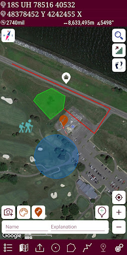
* You can add and removing markers.
* Distance measure. (You can add custom route and calculate total distance)
* Area measure.(You can select an area on the map and calculate the area in square meters)
* You can see the altitude of your location.
* You can find the location according to Address, Degree/Minute/Second , MGRS, UTM or Latitude/Longitude formats.
* Location (Coordinate) unit options.
=> MGRS / U.S. National Grid (USNG) (WGS84/NAD83)
=> D°M'S" (WGS84)
=> Latitude/Longitude (WGS84)
=> UTM (WGS84/NAD83)
=> SK42(Gauss Kruger)
=> British National Grid(OSNG)
=> Irish Grid Reference
=> ED50
=> ITRF
* Map type options (Road,Terrain,Satellite,Night Mode,Hybrid)
* You can share location coordinate.
* Distance unit options. (meter and feet).
* KML viewer. (Export and import KML layers).
Version Information
- Version
- -
- Downloads
- 10K+
- Updated on
- -
- Released
- Apr 9, 2018
- Requires
- Android Varies with device
Statistics
Google Play Rating History
Rating Distribution
Downloads Over Time
Mgrs & Utm Map Pro has been downloaded times. Over the past 30 days, it averaged downloads per day.
Shaded area shows 30-day prediction based on historical trends
Historical data collection started recently. More data points will be available over time.
Mgrs & Utm Map Pro - Google Play Rankings
Top Rankings
| Rank | Country | Category | List | Change |
|---|---|---|---|---|
| — |
Ranking History in
No ranking data available yet. Rankings are updated daily.
#4 in Top Paid Maps And Navigation in United States


#3 in Top Paid Maps And Navigation in South Korea
 Headunit Reloaded Emulator HUR
Mgrs & Utm Map Pro
Headunit Reloaded Emulator HUR
Mgrs & Utm Map Pro
#6 in Top Paid Maps And Navigation in Germany

#11 in Top Paid Maps And Navigation in India

Mgrs & Utm Map Pro users say on Google Play
 Randolph Crommelink
Excellent application! Orienteering becomes a cinch, can easily replace your conventional map in digital format. Very easy to learn, and contains tools that are extensive in functionality. Would like to see the capability to move objects between overlays once they are placed, and downloading of mapgrids for use when working offline.
 Ramon Acevedo
Great app but...i wish I had the option to add grid lines based on military installation map
 Robert Medley
Please make this available on IPhone!! The bass version is available, but pro is not
 Jeff J
Considering this is for traversing difficult terrain I find it absurd that there isn't an offline mode. A lot of hiking is in places where there is no service.
 Redhahari
I bought the Pro version. I opened the KML File from WhatsApp. The file read at box Imported file. Then I try to click it. Suddenly the screen fadeout. Please fixed it because I bought it in order to use it. Not for showing.
ApkTrusted Ratings & Reviews
More from DakikTech
See more apps


Similar Apps

DeRadar
Paid

Orca: Boat GPS, Charts, Routes
Free

Holland America Line Navigator
Free

VesselFinder
Free

YourSweep
Free

My Emotional Compass
Paid
PeakVisor - 3D Maps & Peaks ID
Free

Sun Seeker: Sunlight Tracker
Paid

MysteryHike: Travel & Explore
Free

Südtirol Fishing
Free
PeakFinder
Paid

ShipAtlas - Ship Tracker
Free

Bike Route Planner
Paid

GPS Essentials
Free

Gaia GPS: Offline Trail Maps
Free
Scan this QR code to download

Forwarding you to the page at Google Play market in seconds...
Open Google Play market now