
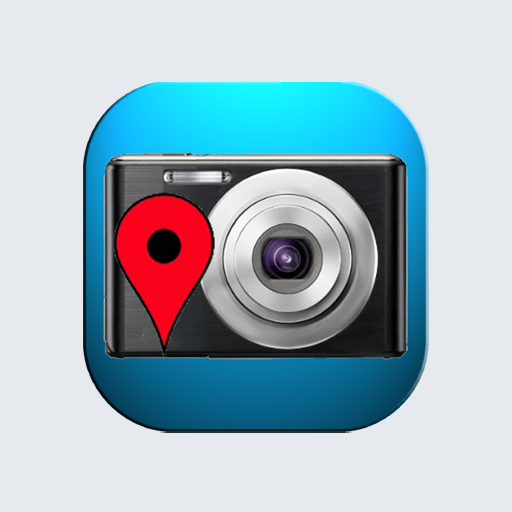
GPS Map Camera: Geotag Photos v1.0.31
Eskimo Technologies Group


About this app
The GPS Map Camera: Geotag Photos app solves the problem of wanting to add context to vacation photos by allowing users to stamp live time, date, and satellite location on their images. This app benefits travelers and photography enthusiasts the most, as it provides a unique way to document and share their experiences. Compared to alternatives in the Photography category, GPS Map Camera stands out with its geotagging feature, but falls short in terms of editing capabilities. With its excellent user rating and moderate download numbers, this app is a top choice for those seeking a simple and effective geotagging solution.
Pros
- The app's excellent user rating of 4.9/5 and moderate download numbers of 100,000+ demonstrate its popularity and social proof, indicating a well-designed and functional app.
- The app's developer, Eskimo Technologies Group, has a professional website and provides a clear email address for support, which suggests a reputable and responsive development team.
- The app's small size and lack of permissions required make it a lightweight and secure option for users, reducing the risk of data breaches or performance issues.
- The app's free with ads monetization model allows users to access its features without incurring costs, making it an attractive option for casual users and travelers on a budget.
Cons
- The app's lack of editing capabilities and limited feature set may make it less appealing to professional photographers or users seeking more advanced editing tools.
- The presence of ads may be intrusive or annoying for some users, potentially disrupting the app's overall user experience and functionality.
- The app's requirement for Android 9 or later may limit its compatibility with older devices, potentially excluding some users from accessing its features.
Best for: The ideal user for this app is a tech-savvy traveler or photography enthusiast, likely aged 25-50, who values convenience, simplicity, and unique features, and is seeking a straightforward and effective way to add context to their vacation photos without requiring advanced editing capabilities.
Developer Description
Stamp live time, date & satellite location on your vacation photos to share.
Don't just take a shot—prove exactly where and when it happened.
🔥 TOP FEATURES FOR USERS:
🌎 Satellite Map View: Switch between standard, terrain, and satellite modes to show the full context of your surroundings. Perfect for outdoor adventures!
🚀 Instant Share: One-tap to share your geotagged photos with friends and family on social media. Let them see exactly where you are exploring.
📍 Precise Geotagging: Automatically add GPS coordinates (Latitude/Longitude), Zip Code, street address, and altitude to every picture.
🎨 Customize Your Stamp: Choose from modern templates to match your style. Adjust the color and layout to make your photos pop.
🛣️ Route & Track: Keep a visual record of your route and hiking trails.
WHO IS THIS APP FOR?
Travelers & Roadtrippers: Document your vacation memories with accurate location stamps. Never forget that hidden spot again.
Social Media Influencers: Create engaging content with "proof of location" for your followers.
Real Estate & Field Work: Easily document property locations or project sites with verifiable time and location data.
Outdoor Explorers: Track your elevation and coordinates while hiking, camping, or boating.
SIMPLE TO USE:
Launch the app and enable location services.
Select your preferred map type (try Satellite view!).
Snap a photo! Your time, date, and GPS map are added instantly.
Make your memories last forever on the map.
Download GPS Photo: Geotag & 3D Map now and start tracking your adventures!
Privacy
Given the app's lack of permissions required, users can be confident that their data is not being collected or shared without their knowledge. However, as with any app, it's essential to review the developer's privacy policy and terms of service to understand their data collection and usage practices. To ensure maximum security, users should also keep their device and app updated with the latest software patches.
Tips
To get the most out of this app, users should first ensure their device's location services are enabled and accurate, as this will affect the app's geotagging functionality. Additionally, users can optimize performance by closing other resource-intensive apps while using GPS Map Camera, and consider purchasing a premium version or alternative app if they find the ads intrusive. By following these tips, users can enhance their overall experience and make the most of the app's features.
What's New
Version Information
- Version
- 1.0.31
- Downloads
- 100K+
- Updated on
- Jan 16, 2026
- Released
- Oct 5, 2025
- Requires
- Android 9
Statistics
Google Play Rating History
Rating Distribution
Downloads Over Time
GPS Map Camera: Geotag Photos has been downloaded times. Over the past 30 days, it averaged downloads per day.
Shaded area shows 30-day prediction based on historical trends
Historical data collection started recently. More data points will be available over time.
GPS Map Camera: Geotag Photos - Google Play Rankings
Top Rankings
| Rank | Country | Category | List | Change |
|---|---|---|---|---|
| — |
Ranking History in
No ranking data available yet. Rankings are updated daily.
#55 in Top Free Photography in Brazil
 AI Photo Editor - Polish
 Film Camera - Vintage Camera
GPS Map Camera: Geotag Photos users say on Google Play
 Md.shahid Shekh
nice
 Sonu Kumar
worst app ever seen no gps no 3d pls don't add this app in your mobile
ApkTrusted Ratings & Reviews
More from Eskimo Technologies Group
See more apps
Recovery: Photo, Video Files
Free

Breakout 3D: Blox Escape Game
Free

Blissful Coloring: Adult Art
Free

ThirstEASE - Water Reminder
Free

WalletWise - Money Manager App
Free

Tough Puzzle: DOP App
Free

Meow Seat Puzzle: Traffic Jam
Free

WipeOut Puzzle: Brain Teasers
Free

Store Packing Sort
Free

Salamio: Quran, Qibla & Prayer
Free

Cake out: Color Puzzle
Free

Mix Beat Game: Music Challenge
Free

456 Monsters: Survival Game
Free

Sound Battle 3D
Free

Tap Arrow Rush
Free
Similar Apps

Earth Map App - Live Cam View
Paid

GPS Navigation Route Planner
Paid

Bike Route Planner
Paid

HiiKER: The Offline Hiking app
Free
GPS Map Camera
Free

WhatsGPS
Free
Geo Tracker - GPS tracker
Free

Avenza Maps: Offline Mapping
Free
Qibla Direction- GPS Compass
Paid

Live Earth Map, GPS Navigation
Free

Footpath Route Planner
Free

Guardians from Truecaller
Free
Save Location GPS
Free

Gaia GPS: Offline Trail Maps
Free

My Emotional Compass
Paid

Guru Maps Pro & GPS Tracker
Paid
Scan this QR code to download

Forwarding you to the page at Google Play market in seconds...
Open Google Play market now